Entering the Shenandoahs: Days 64 - 70

Day 64: 18.2 miles hiked (trail mile 797.8)

All morning we enjoyed an easy hike down to the James River. We hiked along the river for about a mile and saw our first rhododendron buds!

The longest footbridge on the AT is here and it was neat walking across such a wide river on such a narrow bridge. Once across, we began almost immediately ascending back into the mountains; a 4,000ft climb. It’s been in the upper 80’s in the afternoon these past couple days which feels so much hotter while hiking. In anticipation of the heat during the approaching climb, we took a break at a shelter near the base of the mountain to drench our clothes and hair in the cold stream and fill our water storage systems to full capacity. 

At the top of the mountain, we saw (nearly stepped on) a baby bunny right in the middle of the trail and took a moment to gently coax it to hop off trail a couple feet so that it wouldn’t run the risk of being trampled by a hiker.  

There was also a plaque on the very top of the mountain solemnly honoring the memory of a 4-year-old named Ottie Powell whose body was found in that spot in the late 1800’s after he had wandered away from school and become lost in the mountains. 

Once at the shelter for the evening we took care of camp chores while chatting with Boomer, a friendly section hiker. It is the warmest night we’ve had on trail yet and I’m enjoying writing this with the quilt kicked off and using only my midweights to regulate body temperature. Punchbowl Shelter, where we are staying, has a pond right in front of it. There is an impressive chorus of frog song in the air and I’m excited to sleep with the steady ambient forest noise. I wonder if the frogs are what caused a recent Guthooks commenter to write, “a bird kept us up all night mimicking a fire alarm.” 

Day 65: 17.6 miles hiked (trail mile 815.4)

This morning we yogied some toilet paper from 3 nice section hikers in camp who were hiking out today. They understood our plight, affirming that “toilet paper anxiety is real.” They gifted us a couple small rolls of paper and a bag of sea to summit wipes. I had underestimated just how much toilet paper we would need for such a long section so it was a relief to know we wouldn’t have to resort to using leaves. 

First thing in the morning we passed 800 miles!

Around mid-day we hiked a 1.4-mile section that contained ruins from a community of freed slaves that lived there and farmed the land in the early 1900’s. It was wonderful having a wayside exhibit to explain the history of our surroundings today. Often, we see old ruins with little to no explanation whatsoever. 

We once again wet our clothes in a creek before a huge climb. Today feels like a repeat of yesterday: hot, with a huge down followed by a huge up, with no water for a 10-mile stretch. We hiked with Boomer, who kept our minds off the brutal 6-mile climb with great conversation. He is a retired chiropractor from Florida who returns to the AT twice a year to section hike. He has over 900 miles of the trail under his belt already.

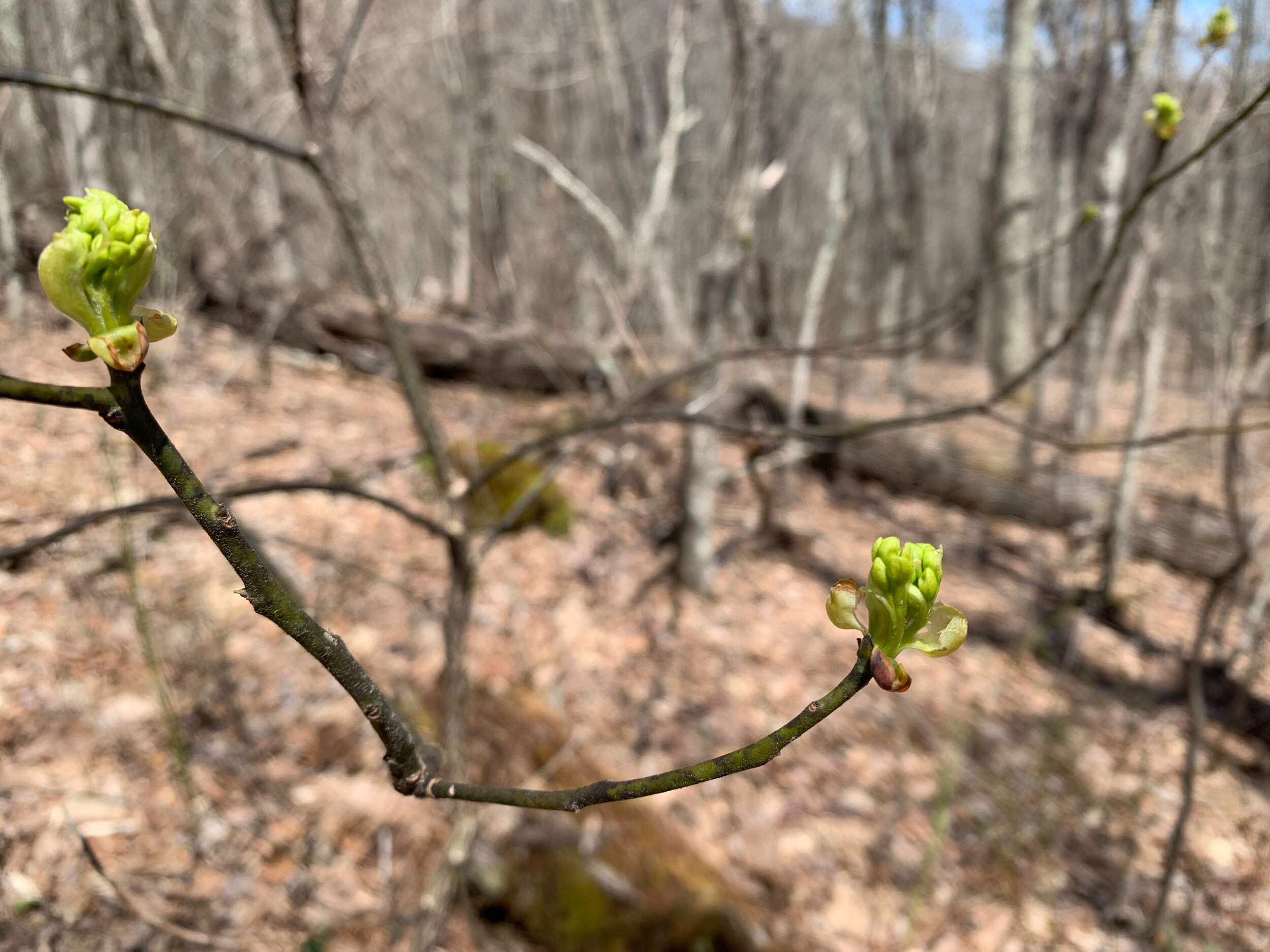
There were tons of flowers on our hike today. It has been amazing to observe the growth of the plants around us as they leafed out and are now beginning to flower. Next will come fruit!

When we arrived at Hog Camp Gap, a windy field very near the ridge line, we said hi to Krash, Garfield, and 92, who were set up near the ridge, then made our way downhill toward the water supply in hopes of finding more protected campsites at lower ground. This was the right call. Only 100 yards or so downhill we found a large campsite with soft pine needles coating the ground and huge pine trees to block the wind. Hot Hands and Dead Eye showed up shortly after, and eventually the other guys broke down camp up top and came down to join us out of the wind. Of the thruhikers, 92 alone weathered the windstorm up top.

Day 66: 21.9 miles hiked (trail mile 837.3)

The wind roared all night, but the tent held up well. I crawled out of the tent at one point in the night just to shine my headlamp up at the tree limbs lashing around above and guyed out the tent to give it a bit more structural integrity. The cacophony made it difficult to sleep. When Garfield emerged from his tent this next morning, he was covered with a layer of dirt that had blown in under his tarp tent.  

We lunched at a shelter with Boomer before parting ways, since we wanted to pull big miles today.

Later, we chatted awhile with Mona Lisa at the Priest shelter where everyone writes their confessions in the trail log. Our confession is that we never write in the trail logs; and this was no exception. It was entertaining reading others’ confessions though. 

After a short stint of night hiking we arrived at Harper Creek shelter, making our longest day of hiking yet at 21.8 miles. It took a good while, but we finally found a flat tent site off on its own in the darkness.

I took an Advil tonight before bed because my aching feet and knees had kept me up the night before. I didn’t want to risk a repeat of that experience when we need to do 22 miles the next day. This is only the second time I’ve taken an ibuprofen on trail, which I’m proud of. 

Day 67: 22 miles hiked (trail mile 859.3)

Sticks found a newly emerged butterfly on the trail with still crumpled wings!

Sticks found a newly emerged butterfly on the trail with still crumpled wings!

When the sun rose and we clamored out of the tent to retrieve the food, we saw that the tent site we had chosen in the darkness beside the creek was in fact an incredible camp site. Although we prefer to have camp set up before dark so that we can have our bearings on our surroundings, there is something wonderful about waking up to a campsite revealed in the morning light.

We got moving around 8am and climbed 3 miles up a mountain. We were both dragging a bit today and around 2pm received a much-needed pick-me-up from a trail angel named Car Hop. We sat around Car Hop’s vehicle on the sidewalk at a vehicle overlook with Dead Eye and Krash, and snacked on Oreos, skittles, Gatorade, and chips. Car Hop completed the AT last year and is now supporting the trail community as a trail angel. He even had hand sanitizer refills, which we had been running dangerously low on. 

Car Hop

Car Hop

That evening we ran into 92, a retired marine who hikes big miles. He and Chris discovered that they shared some community affiliations off-trail, and we were fueled on our last 8 miles by good conversation and camaraderie. 92 pointed out the stone walls we had been passing along the ridge lines in this region and told us that they were old barriers from the civil war.

We had resigned ourselves to stagger into camp around 10:30/11 that night to make our goal of 22 miles but thanks to 92 setting an aggressive hiking pace, we careened into Paul Wolfe Shelter right around 9pm, only night hiking by head lamp for about a half hour. 

Garfield pointed out a suitable decent tent site to us and we quickly set up camp, ate dinner, and hung the bear bags on a bear pole—the first of many as we head into the Shenandoahs. 

Day 68: 4.9 miles hiked (trail mile 864.2)

At last! We made our way out of the woods in a short 5-mile hike from the shelter. We managed to complete the 130-mile Daleville-Waynesboro section in 7.5 days.

It was a beautiful, flower-filled hike out, and just before the entrance to Shenandoah National Park a couple of guys out day hiking (a father and 19-year-old son who we later learned hike together every weekend) offered to give us a ride into Waynesboro. We gratefully accepted and they dropped us at the Quality Inn. We spent the rest of the day doing town chores and recharging. 

The Mayapples are blooming!

The Mayapples are blooming!

Day 69 - mile 864.2 (4th zero)

When we saw the rain coming down this morning and the thunderstorms forecasted for the evening, we decided to hold off one more day before entering the national park. It will be nice to feel fully refreshed going into this next section. 

We walked to the post office, picked up our REI packages and sent more gear home. We finally went back into our Lighterpack gear list and updated it with everything we’ve cut from our packs since the beginning of the trail. Our pack base weight is now down to about 14lbs each! I’ve sent so much gear home at this point I can fit my new z-lite sleeping pad inside the pack. 

850 mile shoes!

850 mile shoes!

We each took an Epsom salt soak in the tub and spent the rest of the day resting. I applied to another scholarship (I found out I received the first one I applied for!) and we both caught up with family on the phone. 

Day 70: 20.8 miles hiked (trail mile 885)

For breakfast we had Beyond Meat sausages with bagel buns, microwaved burritos, cereal, and frozen blueberries. Snapshot set up a ride from Stanimals, the Waynesboro hiker hostel, to get back to the trail. Once back on the AT we almost immediately entered Shenandoah NP. We filled out paper permits and deposited them in a metal box at the trailhead. The main permit attached to the outside of our packs. 

We hiked on and off with Spots and Snapshot all morning and ate lunch on a rock near a spring with Mona Lisa who we’ve learned is a carpenter from New Orleans. 

A storm rolled in suddenly around midday and we welcomed the rain and cooler temperatures after a warm afternoon. After the weather cleared, we saw a small ring neck snake. Later we came upon a grey goose walking northbound on the AT. When it saw us, it waddled quickly around a bend in the trail and was gone when we made it around the bend. 

Just about a half mile from our destination, we found a few cans of trail magic food carefully placed in the center of the trail and lovingly adorned with flowers. We snagged the Amy’s vegetarian chili for dinner tonight and left the other two items for the next hiker. We later learned that Snapshot had scored a beer from this same trail magic cache only moments before we arrived!  

When we walked into Blackrock Hut (the Shenandoahs call their shelters Huts) Dance Party, who we hadn’t seen since the Smokies, was there! She had taken 4 days off right after the Smokies and had been just behind us ever since. She caught us after doing a 24-hour challenge in which she managed to hike 42 miles straight.

Spots and Snapshot pushed on because there were no good campsites left (especially for their 3-person z-packs tent) but with my ankle hurting and only a 2-person tent we were able to find a rocky and root-filled little site that we will have to make work. I expect doing a 21-mile day on shoes right out of the box is what is causing the ankle pain. Tonight is our first night sleeping on our z-rests; the ease of set up is certainly nice but we will see what quality of sleep we’re able to get. 

Woods Hole: Days 49 - 56

Day 49: 12.8 miles hiked (trail mile 558.6)

Today is Chris’s birthday! We enjoyed cereal and donuts for breakfast, with fresh strawberries.

After breakfast we gave the strawberry tops to the chickens, and Chris was sneak-attacked by the rooster a few times. We then spent some time ordering gear online—including new shoes for Chris, an extra battery pack for my phone (we’ve made it this far with a tiny freebie power bank that won’t even give my phone a full charge), replacement odor proof bags, and bug nets. We used the next hostel we plan to stay at as the shipping address.

IMG_3633.jpeg

At 10:30 we started out from hostel with ultra-light packs. We are camping in the woods tonight but returning tomorrow morning for our vaccines and planning to take a Zero at the Long Neck Lair. Because of this we were able to leave half of the stuff we don’t need from our packs at the hostel in a big cardboard box. 

While hiking out of town the pharmacy called and is switching us to the Moderna vaccine because the J&J is being pulled due to reports of rare but severe blood clotting. 

Today we passed a sign on trail indicating that we have now made it a quarter of the way on our thruhike to Maine! We’ve come a quarter of the way! We’ve only come a quarter of the way…

IMG_3637.jpeg

Towards the end of the day, we walked through some pastures, clamoring over the tallest fence ladders we’ve had yet. We didn’t see any cows and were grateful since some of the comments on our map app, Guthook, were about being chased by angry bulls. 

IMG_3646.jpeg
IMG_3651.jpeg

We ended our hike at a campsite next to Possum Creek, a stone’s throw from a parking lot just a short distance from Bear Garden Hostel from which we will be getting a ride back into Marion for our vaccines. The campsite was excellent, although a bit close to vehicle access for our taste. Thankfully we were the only ones here.

Then, a man suddenly approached our tent just before sunset just as we were starting to doze off, bending over to peer into our tent and introduce himself. He said he was looking for a hiker named Victory Girl and was putting up flyers for her to call him so he could help her out. His story was hard to follow and the interaction shook us up a little bit. Weirdness like this is exactly why we prefer to camp away from roads/parking lots.   

Day 50: 0 miles hiked (trail mile 558.6 (3rd Zero!)

We woke up early and walked a short distance to Bear Garden Hostel. Bert (short for Roberta) gave us a ride to Marion with a solo-hiker named Jiffy Bear, an older man who we first met just outside of the Greyson highlands, chain-smoking cigarettes in the shelter in the dark, but this was our first chance to meet him in daylight. Jiffy Bear had been shelter-sleeping the entire way, and carrying a machete, but must have decided that a tent would be more useful than a machete, so was heading to Walmart to pick one up. Jiffy Bear is one of many distinct characters we’ve met out here – it’s always interesting to meet people who break the typical thruhiker mold.

We arrived early in Marion but the pharmacist told us they could go ahead and administer our vaccines. A painless shot in the arm and we were free to go; we will have about 50% protection from Covid-19 in 2 weeks time. In 4 weeks, we will be able to get our second shot somewhere farther up the trail.

IMG_3678.jpeg

We tagged along with Bert and Jiffy Bear on their errands and got a bonus trip to Ingles out this arrangement and were able to pick up more fresh food for our Zero back at the alpaca farm. We knew we wanted to stay here post-vaccine because it was such a relaxing and clean environment where we could enjoy a tub soak and lounge all day.

Day 51: 20.6 miles hiked (trail mile 579.2)

This morning we got a ride from Ken back to Possum Creek, the campsite where we had left off on the trail. We had a nice morning of hiking, both fully aware of how much the day of rest had helped with recovery.

IMG_3680.jpeg

When we reached Lick Creek, we discovered the bridge had washed out so we had our first creek fording. The water was take-your-breath-away cold, and we caught sight of a crawdad scooting through the water around our feet.

IMG_3681.jpeg
Chris demonstrating how cold the water was!

Chris demonstrating how cold the water was!

Around midday we hiked through a burned section; a wildfire had ripped through the area only the day before. Although thruhikers were permitted to pass through the area, wildfire fighters were still combing the perimeter of the burned area. One of them told us they had been working nonstop since yesterday. 

IMG_3695.jpeg

While lunching, perched on a log, we met Splinter and Turtle Power, a couple of retired guys who are platinum blazing the trail. Platinum blazing is where you hike during the day and sleep in hotels, Airbnb’s, etc. at night. They have two vehicles and always leave one at either end of the section they’re on that day. 

Turtle Power and Splinter

Turtle Power and Splinter

From there we hiked up to Chestnut Knob Shelter where we were reunited with Blue Jacket, and Squirrel with his well-behaved scruffy dog, Texas. 

IMG_3705.jpeg
IMG_3707.jpeg
Definitely one of the nicest shelters we’ve encountered

Definitely one of the nicest shelters we’ve encountered

Determined to pull a 20-mile day today (and forced to move on due to the lack of water on the ridge) we decided to carry on hiking into the night. Just before dusk we encountered a few deer which acted unafraid of us. We night hiked for a couple hours as a surprisingly cold night set in, temperatures dipping below freezing. We also saw a speckled salamander by headlamp!

The deer blend in with the forest so well

The deer blend in with the forest so well

At 20.7 miles, just after breaking our mileage record, we stopped at the first stealth campsite we could find. We hung our loaded bear bags, chugged some water, skipped dinner and got into our quilts. The night is clear, so we are sleeping without the rainfly.

Day 52: 16.8 miles hiked (trail mile 596)

We slept well at our little stealth-site although the temperatures fell into the twenties rather unexpectedly and in retrospect, we wished we had put the rain fly on for the 10 degrees or so of warmth it adds (but couldn’t be bothered to get up in the night to improve our situation). We are getting more confident with our bear bagging, too. Chris is skilled at flinging the rock bag over just the branch he’s aiming at, and I’ve developed a system for tying it off neatly, so we take on the task as a team each evening. In the mornings I’m usually the first to go retrieve the bag, driven by the promise of breakfast. We are eating more cold, ready-made breakfasts now to save on time and cover more miles.

We hiked until about noon and braked for lunch at a surprise picnic table near a road crossing. It is a rare treat to have a table or a bench on the trail, so we usually stop to enjoy these luxuries when they make an appearance. We rehydrated a pouch of freeze-dried chili, ate it with a side of Fritos and fresh spinach, then filled up 5 liters of water to carry us through until next morning, since there is no good water source to be had for the next 15 miles or so. 

There was about a mile and a half of road walking today. During our road walk we met Rabbit, a fast-moving, young solo hiker who is going to law school at Berkeley when she is finished with the trail. We also saw a weasel crossing the road! 

In the last mile of our hike, we ran into Hothands, who was planning to push on to Jenny Knob shelter. When we made it to our tiny campsite on a ridge line around 7:30 we got set up quickly, took care of camp chores, and were in the tent before sunset. 

Day 53: 17.9 miles hiked (trail mile 613.9)

IMG_3727.jpeg

We had a good night on the ridge. The winds stayed fairly calm and temperatures hovered in the mid-thirties. On our hike we met Sunrise, a hiker who is starting at Harpers Ferry and hiking to Springer then flip flopping to hike Harpers Ferry to Katahdin. She assured us that Woods Hole, our next shelter, was sure to be an incredible experience. Dr. Who had also advised us early on in our hike, while we were still in Georgia, that Woods Hole was a special hostel.  

Hiking down from the ridge we passed through a more open area, part field, part woods, filled with blooming flowers and trees. We then crossed a neat suspension foot bridge.

IMG_3734.jpeg

On the other side of the bridge, we ran into a dayhiker from Salem, VA, that we had seen on and off during her hike today and she gifted us a small tangerine. A burst of fresh flavor, however small, is so welcome on the trail, especially when we are toward the end of a 4-5 day section and subsisting only on processed foods.

We eventually settled down for the evening in a small unofficial campsite tucked in between rhododendron groves. Much of the end of our hike today was through long stretches of rhododendron tunnels which are quite dim and make us feel like the sun is setting even when we have a few more hours of daylight left. Long rhododendron stretches make me feel a bit broody, a bit like hiking in fog does.

IMG_3743.jpeg

Day 54: 11 miles hiked (trail mile 625.5)

Ranger, enjoying a pot of gruel (aka Great Value Oatmeal) for breakfast

Ranger, enjoying a pot of gruel (aka instant oatmeal) for breakfast

It was a cold morning, so we took the time to make some instant oatmeal we had found in a hiker box and wait for the sun to reach us. Our morning hike took us through a pine forest (always exquisite) and more rhododendron tunnels. We snacked next to a man-made pond with some lovely, well-maintained campsites around it before continuing the rest of our short 11-mile day to the detour for Woods Hole Hostel, then another half mile down a gravel road to the hostel. Even though we will stay at a hostel in Pearisburg, 13-miles up trail, we had heard wonderful things about Woods Hole and had logged it as a must-stay hostel along the trail.

IMG_3747.jpeg

At the hostel we met Singing Hawk, who is working at the hostel this season. He has a meditation podcast and is going to be returning to the trail in June to complete his hike from last year. Neville, the owner, led a free yoga class for all the hikers in a circle on the lawn. She is a mindful, creative, and sustainability-focused person with a magical touch for the hostel business.

Neville and her rescue dog

Neville and her rescue dog

There are 3 friendly dogs and 2 cats at the hostel, and one of the dogs kept eagerly running from person to person during the yoga session to jam his nose under a hand or arm in search of affection. 

The hostel is steeped in history and filled with interesting art and antiques and other knickknacks. You can tell that every little thing is given careful attention, including the systems that are in place to keep the hostel running smoothly. There are little hand-painted notes everywhere to provide guidance to newcomers. 

IMG_3775.jpeg

Because there was a mix up with our room, we ended up being moved to a different part of the house: a private lofted space in the original log cabin part of the home before it was added onto. The space is so charming, and we felt as though we had our own apartment, complete with a dining room table, sofa, wood burning stove which exuded an incredible amount of heat and sleeping loft with a view over the farm and mountains beyond. We could hardly believe our luck. For dinner we had a loaf of homemade fresh baked bread and dipping oil from the hostel combined with some mashed potatoes and jam that we had in our packs. 

IMG_3799.jpeg
IMG_3795.jpeg
A personal loaf for each hiker… heaven!

A personal loaf for each hiker… heaven!

We received all our REI packages that we had ordered from the Alpaca Farm and Chris reveled in the feeling of having new shoes. His shoes had fully blown out on the sides by the time we hiked up to Woods Hole, fully exposing his sock in places, so he was well overdue for some new ones. We kindled a fire in our wood burning stove and checked out some of the interesting books in the little library in our room until it was time for bed. Chris found an anatomy book and I photographed some of the pages with my phone so I can study up on some basic anatomy knowledge while hiking to prepare for grad school. 

Day 55: 11.6 miles hiked (trail mile 637.1)

IMG_3850.jpeg

Neville led us all in a gratitude circle after ringing the breakfast triangle on the patio. We all went around the circle and voiced our name, where we are from and something we’re thankful for. I’m thankful for this hostel, which is the perfect place to nourish body and soul.

Following, we enjoyed a huge family breakfast that fed about 20 people with peach cobbler made from peaches from the Amish community down the road, fresh baked bread with an assortment of homemade jams and hummus, farm fresh eggs cooked in a giant cast iron skillet, oatmeal with syrup and fruit and seeds, a salad with greens from the garden, and leftover homemade espresso cake. When we settled with Neville before departing, we left a donation for the Broke Hiker Jar. It’s a unique idea to allow hikers to pay it forward to one another and allow a hiker without the funds to still partake in a community meal or receive a bunk at the hostel. We receive so much kindness and generosity out here we were glad to partake. 

IMG_3808.jpeg

After breakfast we headed back to the trail on the road, Chris wearing his new shoes and insoles, and with them a fresh outlook on life. We hiked awhile with 4 hikers that call themselves the Hikers Union, including Ninja Kitty and Mona Lisa. They are fast hikers, so we lost them quickly, but enjoyed their good spirits. 

IMG_3817.jpeg

We hiked along a ridge for a while and ate pb&j tortillas while perched on a cliff overlooking Pearisburg, where we are headed. As we reached lower elevations the woods became vibrant green and coated with wildflowers of all different colors. 

IMG_3822.jpeg
IMG_3849.jpeg

Doc Pepa, owner of Angels Rest Hiker Hostel where we are staying tonight, picked us up from mile 637.1 at the parking lot on-trail near an old cemetery. We are sleeping in a room inside the house, which has a fully equipped kitchen we can use. We ate an oily dinner at the Mexican restaurant across the street and later regretted not using the kitchen at the hostel to make something more nourishing. After dinner we did a resupply run at the Food Lion and Walgreens then returned to the hostel to repackage food for our trek to Daleville.

Chris chatted in the kitchen with the hiker staying in the room across from us, Sky, while I hid in our room and caught up with family back home. The trail can feel so social sometimes that when I’m at a hostel I find myself taking any moment of private time I can get.

Day 56: 18.1 miles hiked (trail mile 675.2)

This morning we had to shuttle around a 20 mile section that has been closed to hiker access for months now due to a storm that damaged some major power lines and blew down a bunch of trees. There have been rumors of hikers trying to traverse this section despite the warnings. One decided to turn back and exit the way he’d come. Another made it through, but it took her twice as long because of the blow downs and overgrown trail. We’d rather just come back and fill in this section at the end on our road trip back to Texas.

The last 20 miles

A note from the future: We did end up coming back to complete this section on our road trip back to Texas. We weren’t purists in the most rigid sense, but since we had the opportunity to not skip a whole 20-mile section we decided why not. The month after we summitted Katahdin, we pulled into Angel’s Rest Hostel with my sister, Andrea, and tented/hammocked in the yard. Early the next morning, Doc Pepa drove us to the far point so we could slack-pack back to the hostel. It was so much fun giving my sister a taste of the trail, and the gentle rolling hills of Virginia were a treat after the physical feats required by the most northern parts of the trail.

We woke up early to shower and eat some cereal before our shuttle arrived at 8:30 with a couple other hikers in it, Glacier and Bachelor Party. We were dropped off at mile 657 and began a steep ascent back up into the mountains. At one point we heard a fighter jet flying low through the mountains. You can’t help but stand still and observe when they do this because the sound is so powerful and reverberates throughout the mountains. After the first major ascent we stopped for a short break at a shelter where Chris found a neat, melted hunk of glass near the fire pit. Someone had installed a nonfunctional outlet in the shelter as a prank. Cruel and hilarious!

IMG_3865.jpeg

While lunching on an overlook, Chris saw a Black Hawk Helicopter which glinted at us in the light. The hike was challenging with our full packs, the steep elevation changes, and rocky terrain. It rained on us a bit about 4 miles from the shelter, but the sun went on shining, and we witnessed a vibrant rainbow through the trees. 

When we finally made it to the shelter just before sunset, we were surprised to find the largest crowd we’ve encountered since the Smokies: 4 in the shelter and about 12 tents around it. It was not a great area for bear bagging, but we found a branch that will at least present an obstacle for the bear. We ate chili with Fritos on a log beside our tent in the dark, moon in half-waxing phase above us. Turns out we did just over 18 miles today… not bad, all things considered. We are falling asleep to the pleasant sound of light rain on the tent.

Virginia is for (Alpaca) Lovers: Days 42 - 48

Day 42: 7.3 miles hiked (trail mile 471)

A couple miles outside of town we encountered Blue Jacket on trail and ended up hiking with him all the way down to Damascus. We all stopped at the local diner with our packs on the way to our hostel and ate veggie burgers at the patio tables out front.

IMG_3416.jpeg

Once checked into our hostel we visited the two outfitters down the street to survey the selection, and then took a short nap in our room before making our way to the local Food City grocery store. It was a pretty, flat walk to the store on a trail next to the river. The store had a surprisingly good selection. We probably bought way more food than we will be able to eat while in town but will give it our best try. Leaving the store, we were absolutely loaded down with bags, and a guy pulled over almost immediately to offer us a ride back to our hostel about 1.5 miles away. We accepted gratefully and rode with him and chatted with windows down all the way back to our hostel.

IMG_3425.jpeg

For dinner I made a huge veggie and tofu stir fry while Chris repackaged food from the store. Repackaging food is a whole ordeal since you don’t want all the extra packaging weighing down your pack and taking up space! It’s a satisfying task, and something I’m honestly going to miss when I’m back in the real world. It also makes us hyper aware of just how much unnecessary waste food packaging creates…

IMG_3422.jpeg

Day 43: 5 miles hiked (trail mile 477)

First thing in the morning I sprayed our hiking clothes and tent base with permethrin in anticipation of the higher volumes of black flies, ticks, and mosquitos that spring will bring. It is still early in the season, but we figured why not be prepared. After, we made a lovely breakfast at the hostel and prepared for a day of logistics. “Nearos” (near zeros) are not very restful but are still a chance for our bodies to take a break from lugging around the backpack weight. 

I walked to the outfitter down the road and replaced my Superfeet insoles which are supposed to be replaced every 500 miles. My feet had started to recognize every rock and root beneath them, and I pulled out my insoles in Damascus only to discover that they were absolutely crushed in certain places… offering almost no protection. It feels amazing to have fresh cushion in my shoes. Chris needs to replace his La Sportivas shoes soon; they have both blown out on the sides. My Solomons may have another few hundred miles in them, especially now that I have new insoles. I’ve been really impressed by the build and durability of this shoe, especially watching many Altra users replace their shoes after only 300-400 miles.

We decided to ship home some of our gear that we barely ever use, including some of the winter gear that we hardly touched even when it was at its coldest. This shaved 4.5 lbs off our packs! Good thing, too, because we are packing out an absurd amount of good food this time, including a half-full gallon bag of vegetable stir-fry leftovers, hummus, vegan cream cheese, bagels, a gallon bag of spinach, and other fresh goodies. 

We left town around 4pm by way of the AT and Virginia Creeper biking trail which run parallel to one another, occasionally merging into one, for the next dozen miles or so. About 6 miles in we stopped at golden hour at a campsite tucked right between the AT and the Virginia Creeper Trail. It was a beautiful site, near a bridged creek. This was after skipping over a campsite that a Guthooks user had commented something to the effect of, “this used to be such a nice campsite until all those people were murdered”. Pretty good trick to deter campers if you asked me… I wasn’t going to take any chances. We dined on cold veggie stir fry from a ziploc bag with hummus and ritz crackers. 

These little guys are everywhere

These little guys are everywhere

Our food bags were so stuffed that we couldn’t even close them completely, but we figured out a trick for hoisting the rope that made a huge difference. Once the string was looped over a strong branch, I wrapped the end we needed to tie off around my trekking pole and just walked it back as far as I could, wrapping the string around a tree a few times before tying it off. This method is going to be a game changer! Tonight’s lows are in the 40’s so we are going to try sharing one quilt, draped over the both of us. 

IMG_3432.jpeg

Day 44: 15.7 miles hiked (trail mile 492.7)

Breakfast this morning consisted of the last of our cold veggie stir fry leftovers, scooped straight from the gallon bag with ritz crackers and vegan cream cheese. A weird breakfast, but nourishing—and that’s what matters. The hike was beautiful though uneventful. We hiked along the Virginia Creeper trail for a short section where the trails overlap and families on bicycles whizzed past us. At one point in the woods, I spooked a wild turkey, and it flew off through the trees, thumping its wings heavily to carry its large body into the air. We also ran into a section hiker who caught a rainbow trout in the creek.

Cyclists on the Virginia Creeper Trail

Cyclists on the Virginia Creeper Trail

IMG_3440.jpeg

During the last leg of our hike, we crossed a bald just a few miles below Mount Rogers. It had begun to rain, and the winds picked up right as we crossed it. We were rewarded with a glorious double-rainbow that touched the very mountaintop we were on; how amazing it was to see the end of a rainbow! 

IMG_3455.jpeg

We stopped to camp at a large, designated camping area and ended up with a lumpy site down the hill. Ever the last ones into camp we often end up with the least desirable site. We ate the last of our perishables and strung up the bear bag before sleep. 

IMG_3458.jpeg

Day 45: 17.5 miles hiked (trail mile 510.2)

IMG_3509.jpeg

Only a few miles into our hike this morning we came across a public trash can at a parking lot before crossing into the ascent to Mount Rogers. We joyously dumped our trash weight (it’s the little things!) and hiked up to Thomas Knob shelter with extra spring in our step. Here we encountered the much-anticipated herd of wild ponies.

IMG_3478.jpeg
IMG_3495.jpeg

The parks service introduced the ponies to the Grayson Highlands in the 60’s as hardy range animals that could graze the balds. They free-range in a huge territory and are obviously comfortable with backpackers and dayhikers. A few are almost friendly, while most seem to keep their distance merely out of disinterest. A particularly food-motivated one ate a carrot that we had packed out right out of Chris’s hand and let me touch its mane!

IMG_3529.jpeg

There are incredible campsites all over the Grayson highlands, and we mused that this would be the perfect section to return to and backpack with friends or family on a shorter trip.

IMG_3538.jpeg

We enjoyed our hike through the highlands very much, and as we hiked on, we were met with spectacular views and wild ponies everywhere. Around mid-day we also crossed the 500-mile mark! Later we clamored through Fat Man Squeeze with our packs and hiked through a short section of Greyson Highlands State Park.

IMG_3532.jpeg
IMG_3545.jpeg

At the next shelter we ran into Monchichi, a solo hiker we first met back in Damascus at our hostel. She was receiving a tongue-bath from a bold pony who has figured out that thruhikers are basically walking salt-licks.

IMG_3551.jpeg
IMG_3563.jpeg

We hiked on to Old Orchard Shelter, eyeing a storm off in distance that had been threatening to form all day. The last six rocky miles of our day absolutely wrecked our feet so it was a relief to finally hobble into camp. At our tent site we tried a delicious backpacker meal dessert cobbler by Alpine Air and ate trail mix for dinner… because we can! It started raining as soon as we finished up our chores and got in our tent. Perfect timing.

Day 46: 14.1 mikes hiked (trail mile 524.3)

It rained all night and winds rattled our tent but we both slept well. We broke down our damp tent and left camp around 9. Luckily, we enjoyed nice weather all morning despite the storm clouds still looming in the distance and hiked strong all day. The terrain was much better than yesterday’s rocky trail, so our feet are happy again. We did a little 1.5-mile road-walking section because of an official reroute due to a downed bridge.

Buds everywhere are exploding into life

Buds everywhere are exploding into life

At about 3pm the rains arrived, and we hiked another couple miles before deciding to stop at the nearest shelter for the night in anticipation of the coming storm. 

Attempting to hang dry our clothes as our tent is battered by rain

Attempting to hang dry our clothes as our tent is battered by rain

We pitched our tent a little way uphill from the shelter at a site that looked like water would run off rather than pool and got to call it an early night - all camp chores completed by 6pm.

Virginia has been such a treat after Tennessee which was incredibly minimal in terms of trail resources. Someone told us that Tennessee folk believe in roughing it, which certainly seems plausible. Whatever the reason, Tennessee makes up for its bare-bones resources with the incredible natural beauty and mountain balds. In stark contrast, every shelter we have encountered so far in Virginia has bear boxes and nice privies. The shelters appear well constructed; each one is architecturally unique.

Day 47: 12.1 miles hiked (trail mile 536.4)

It rained hard most of the night but tapered off and eventually stopped a few hours before dawn. Love it when this happens. We took a couple hours to lay in our tent and read while our gear dried out a bit.

Chris hung all his wet clothes on his pack to let them dry in the wind!

Chris hung all his wet clothes on his pack to let them dry in the wind!

On our hike today we crossed paths with another nonvenomous snake that was in the middle of a hunt! It was an easy 9.5-mile hike to the Partnership Shelter, also known as the Pizza Shelter, because it is located near the Mt. Rogers Natl. Rec. HQ which has a free landline phone outside that hikers can use to call for pizza delivery.

IMG_3583.jpeg

Not ones to pass up the opportunity for extra calories, we ordered an extra-large supreme pizza with no cheese, with salads and onion rings. When it arrived, we doused it with nutritional yeast and bacon bits and gulped down the entire thing. Since the pizza shelter didn’t allow tenting, we decided to push on to the next tent site and call it an early night since we only have about 10 miles to go tomorrow to reach the alpaca farm we’ll be camping at. We found a good site about 2.5 miles in and decided not to push our luck since this section has so many dead trees which can make campsite selection challenging. 

IMG_3586.jpeg

Day 48: 9.4 miles hiked (trail mile 545.8)

This morning the trail went right past an early settler’s museum and schoolhouse. The museum was closed for the winter, but the schoolhouse was open for anyone to step inside and look around. I suspect hikers may shelter here from time to time.

IMG_3592.jpeg
IMG_3593.jpeg

All day we hiked through beautiful spring scenery: tiny white flowers powdered the ground like snow and yellow swallowtail butterflies danced all around.

IMG_3595.jpeg
IMG_3596.jpeg

During a short boardwalk section of the trail, we saw an alligator snapping turtle the size of a toilet seat cover (thank Ranger for this analogy, accurate albeit weird) beneath the swampy waters. Exiting this section, we encountered our first directly-on-trail gas station/convenient store. Here we picked up some snacks to fuel our short hike up to our hostel, a functioning alpaca farm called the Long Neck Lair.

IMG_3597.jpeg

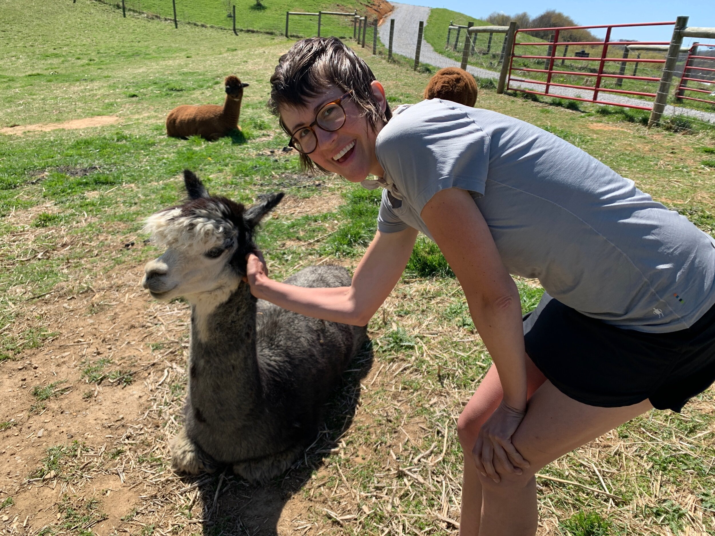
Since the hostel (more like an Airbnb, but the hostel is in the works) was full, we set up our tent on the side of the house where we would have some protection from the winds. The owners’ daughter, Meghan, gave us a tour of the property and we got to meet the alpacas. A couple of them let us scratch their necks!

IMG_3611.jpeg
IMG_3617.jpeg

At the hostel we got to know Cornpop and Suzanne a bit, who we have bumped into a few times over the last few days. Suzanne cooked and dehydrated most of her food before leaving for the trail and is receiving shipments all the way up the trail so she can continue eating plant-based, and sustainably, while on her thruhike. So inspiring!

My generous aunt Pammy, who has worked tirelessly to locate a vaccine for us, sent us a link to a vaccine finder and we managed to secure a couple slots for the J&J one-shot vaccine in Marion for the day after tomorrow! The pharmacist was super accommodating and even listed our address as the pharmacy’s own to help us be considered eligible as residents of Virginia. Once we secured our appointments Cyndi, the owner of Long Neck Lair, drove us into town to resupply at Ingles.

Back at the Hostel that evening we met a lovely couple from Lehigh, PA who were road tripping to Tennessee. They invited us to contact them when we get to their area for some trail magic and a place to stay!

IMG_3627.jpeg

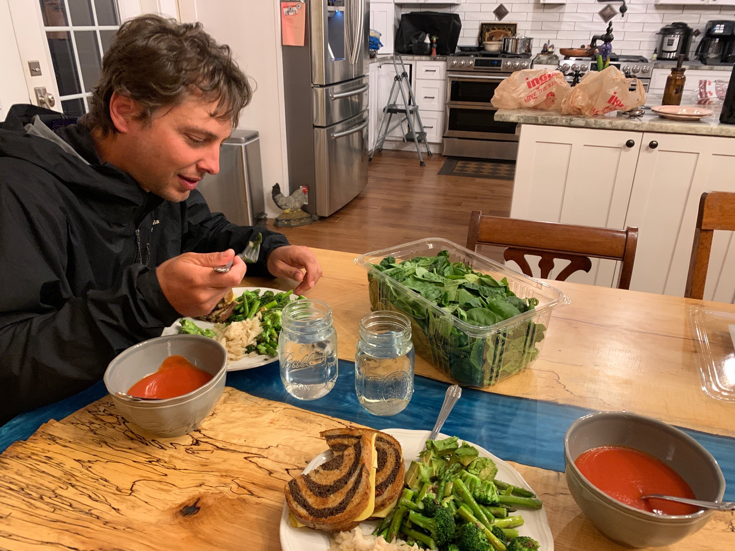
For dinner I cooked plates of asparagus, broccoli, and garlic with vegan grilled cheese and tomato soup in celebration of Ranger’s birthday. 

IMG_3622.jpeg

Cold Snap: Days 34 - 41

Day 34: 20.3 miles hiked (trail mile 364.5)

We rode with Charlotte (the owner of Uncle Johnny’s Hostel) and Kitchen Sink to Iron Mountain Gap to slackpack back to our hostel. In hiking SoBo, we passed most of our friends hiking back up the mountain with their packs, including Spots and Snapshot, Bee, all of team Rocket, and Smoky. The first part of the hike was very cold until we generated enough internal heat through movement.

Smokey

Smoky

Spots and Snapshot

Spots and Snapshot

During the first half of the day we hiked through a gorgeous spruce forest on top of Unaka mountain. Lots of ethereal ice patterns had formed between tree roots and in little grooves and pockets on the trail.

IMG_3176.jpeg
IMG_3182.jpeg

Only a few miles from the hostel we saw our first nonvenomous snake! In all, we hiked 20.3 miles down the mountain today and should be well positioned to make it to the next hostel before the weather turns severe once again. The evening was spent packing and preparing for an early departure tomorrow. 

IMG_3192.jpeg

Day 35: 19.7 miles hiked (trail mile 384.2)

with full packs. It was a beautiful day for hiking and hard to believe that a storm would soon be rolling in. We hiked strong and braked for lunch around the 11-mile mark, a bit startled by how much ground we had covered by noon. Perhaps we had only needed to do a 20-mile day yesterday in order to break our own thresholds and teach our bodies that we could do it. 

One of the wonderful things about hiking in cold weather is being able to pack out fresh food without it spoiling, so we enjoyed a couple sandwiches and a bag of spinach and salt & vinegar chips.

IMG_3209.jpeg

After lunch we summitted Roan Mountain, climbing through another rare and protected spruce forest. Icicles hung all over the mountain and further enhanced the beauty of it all.

IMG_3214.jpeg

On top of the mountain we took a short detour to check out Roan High Knob Shelter. At over 6000 feet elevation the shelter is fully enclosed like a cabin to protect from drafts. This is the first shelter we’ve encountered like this. It is 2 levels, and enclosed on all sides, even with a front door. We would have liked to stay here, but with a winter storm arriving tomorrow we opted to position ourselves for less miles to cover tomorrow in order to give ourselves a better chance to make it over the last couple balds to make it to our hostel before the most severe weather hits. 

IMG_3227.jpeg

We hiked over Jane Bald and took a moment to rest our feet when the rest of the crew finally caught up to us (we would have been a few miles behind them were it not for the slackpacking yesterday). We saw them coming from far off in the distance and could easily identify Spots and Snapshot from their gaits.  

IMG_3248.jpeg
IMG_3238.jpeg

We begrudgingly decided to set up camp at Stan Murray shelter as there seem to be no good spots to camp along this ridge which is super gusty. In defiance of the weather, Spots and Snapshot followed through with their plans to camp at a spot on one of the balds they’ve visited before in training for the trail. It is going to make for an interesting night... After a 19.75 mile day we are exhausted. I’m practically falling asleep writing this (as I write these daily summaries each night I usually have to call it when I start dropping the phone on my face as I fall asleep mid-sentence).

IMG_3242.jpeg

Day 36: 11.1 miles hiked (trail mile 395.3)

IMG_3263.jpeg

The wind gusted all night and the rain arrived around 5am. We broke down camp at first light and scarfed down some animal crackers (mmm, nostalgia) in the shelter before setting off to cover the next 6 miles of balds before the thunderstorm was set to arrive around midday. We moved as quickly as we could (rain gear and waterlogged packs are so cumbersome) and managed to make it over Hump Mountain before noon. From there we began our descent to Mountain Harbor Bed and Breakfast where we plan to wait out the winter storm and take our second Zero. Our joints seem to be doing better overall but this last mountainous section was a huge push—40 miles covered in 2 days—and our bodies are feeling it. 

IMG_3265.jpeg
IMG_3252.jpeg
The trail inevitably turns into a creek in massive rainfall. Our Sealskin (not real seal skin) socks have become a favorite piece of gear out here.

The trail inevitably turns into a swollen creek in heavy rainfall. Our Sealskin (not real seal skin) socks have become a favorite piece of gear out here during winter storms.

We hiked a bit with Snapshot and Spots, who caught up with us about a mile from the hostel. Sure enough, they had camped on top of Grassy Bald and had a rough night; the winds were so high that at one point their tent (a Zpacks Triplex) collapsed. We parted ways with them about a half mile from the hostel when we decided to stop for lunch during a break in the rain. It was nice to slow down after such a rush out of the mountains and take a moment to appreciate our surroundings. Chris explored a small cave above our lunch site that only went back about 10ft. 

IMG_3278.jpeg

At mile 395.3 we turned left off the trail and onto a highway with a huge shoulder that we followed for about a quarter mile to the bed and breakfast/hostel. All the bunks were full because everyone else is also trying to escape the pending winter storm, so we ended up with a higher priced room in the main house, but are looking forward to an excuse to spoil ourselves a bit. 

When we arrived, we knew immediately we would enjoy our stay here. The place is very charming, consisting of an old barn-turned-hostel, a creek with a footbridge, outdoor patio, tiny resupply shop, food truck, treehouses, a mama duck sitting on her nest, and a big red house up the hill where we are staying tonight. 

IMG_3279.jpeg

We picked up some loner clothes from the hostel so we could get showered and have clean clothes to change into while our other clothes are in the wash. At the hostel we met Mustard and Dr. Katahdin. After showering and taking a short nap we met the others down at the back side of the hostel where the little general store and food truck are. With no set hours, the faimly opens them up when asked. It’s so cool what lengths some hostels go to take care of thruhikers. We ordered veggie burgers with fries and onion rings from the food truck and ate with Spots, Snapshot, Caramel, Rocket Man and The Curator at a picnic table in the lower part of the hostel. 

After dinner we relaxed in the living room in the house. The family that lives here has 3 sweet old dogs. Rose, their ultra-affectionate boston terrier, crammed herself between me and Chris where she snored away contentedly.

IMG_3294.jpeg

I worked to publish the latest blog post on my phone and Chris read a copy of Thoreau’s book A Life Without Principle that he found in our room. We drank tea from the little tea station in the kitchen and agreed that this hostel has all the trappings of home and is the perfect place to rest. 

Day 37:  0 miles hiked (trail mile 395.3) – 2nd Zero

With temps in the teens outside and still aching from our push over Roan Mountain, we giddily opted to take our second zero. Most of our crew chose to do the same. In the morning we joined everyone for breakfast and enjoyed some apple cinnamon oatmeal. We chatted with a man carrying a ukulele with him on the trail which he played a bit for us - very talented! A classical guitarist by trade, he tells us he usually hikes with a mini classical guitar.

After breakfast we hung out with The Curator, Caramel, Spots, Snapshot and Rocketman in the living room while our hosts flipped our rooms. Chris and I are staying in the hostel tonight because a cheaper room came available. The hostel has a couple cats that are very sweet. Also, the ducklings hatched overnight! It’s difficult to catch a glimpse of them, as the mama duck is protectively sitting on them to provide warmth in this snowstorm. 

IMG_3307.jpeg

We got moved out of the house into our new room in the hostel where we spent a few hours just lounging. It’s a cozy nook with a full-size bed and rolling doors that block the space off from the bunkroom. I wrote some postcards and applied for a scholarship on my phone for the next chapter after I finish the trail and move to Scotland for grad school. Fingers crossed. Chris also did some adulting and then took a little nap. We ate dinner with everyone and once again enjoyed veggie burgers, fries, and onion rings. Early to bed tonight, and tomorrow we will hit the trail again. There is much less elevation in this next section than we’ve done in this past month so it should feel like we’re soaring. 

Day 38: 18.4 miles hiked (trail mile 413.7)

IMG_3323.jpeg

As hard as it was to leave the comfort of Mountain Harbor, we were equally ready to be back on the trail. We had some apple cinnamon oatmeal for breakfast as we packed and caught a glimpse of the mama duck cautiously leading her ducklings out of the nest.

IMG_3318.jpeg

Our hike went smoothly. The elevation changes were only moderate, and we kept moving to stay warm in temperatures that hovered around the upper thirties and lower forties depending on whether we were on a sunny or shady side of the mountains. From a small field we caught a glimpse of the balds we passed over just before the winter storm. We could see snow on them from here. We also took a short detour to see a waterfall which had frozen over in some areas. Beautiful!

IMG_3325.jpeg
IMG_3331.jpeg

Chris did some trail-maintenance volunteer work on this section of the trail back in 2005 on his first thruhike so memories came flooding back to him all day as he recognized parts of the trail.  

IMG_3337.jpeg

As much as we have enjoyed hiking without headphones for the first month of the trail and agree that it has strengthened our connection, I have begun trying out listening to audiobooks on the trail. I reserve only an hour or two a day for this to preserve phone battery. The rest of our time is spent in conversation or silence.

We started looking for campsites around mile 15.5 but ended up hiking 18.4 to a shelter because there was nothing suitable before it. We managed to make dinner and my fingers nearly froze trying to hang the bear bag over the tall branches at the campsite just as darkness set in. It is going to be a Very cold night, so we are burrowed under our quilts and even used one of our HotHands packets from my aunt Pammy. As I type this I’m completely cocooned inside my quilt.

Day 39: 12 miles hiked (trail mile 425.7)

An owl hooted nearby all night long. With the temperatures in the teens overnight we took our time emerging from the tent in the morning so the sun would have time to warm our site a bit first. We found a frozen mouse lying near our tent in the morning. Spots and Snapshot hiked by as we were packing our bags to leave and said their full water bag (they use a gravity filter system) was hanging in a tree overnight and froze rock-solid. 

Around noon we saw two bald eagles circling overhead. We hiked 6 miles on the trail and turned right at a parking lot to road-walk half a mile to Black Bear Lodge to resupply for the next 50 miles to Damascus, Virginia. We are loving the greater frequency in towns/hostels in this region as it allows us to carry less food between resupplies, which lends to higher-mile days.

When we got to Black Bear Lodge the owner let us into the general store and we found the usual meat and dairy-free trappings: Quaker oatmeal for breakfast, random lunch items (including a dehydrated flax and berry thing that I’m actually really curious to try), Knorr Sides Spanish Rice for dinner, and pop tarts, chips, and granola bars for snacks. We are beginning to tire of some of these things already so will need to figure out how to mix it up more. We bought a couple cans of Amy’s soup for immediate consumption and the owners of the hostel let us use the “bear den” to heat up our soup in bowls in the microwave. We ate lunch at a picnic table overlooking a wide creek and watched a man catch one fish after the other with his fishing pole. When we finished eating and packing our resupply into our bags the hostel owner offered to drop us back at the trailhead—so nice! We hitched a ride on his golf cart.

IMG_3345.jpeg
IMG_3353.jpeg

Back on the trail we made a super steep (and long) descent down to Laurel Falls waterfall and had a beautiful hike along the river, including a narrow section of trail cut into the cliff-face, with the river flowing to our left, before heading back up into the mountains. Despite a late start and breaking to resupply we still managed 12 miles today, which we are pleased with. We made it to our campsite destination of Pond Flats in time to make dinner, bear bag, brush our teeth and get in the tent before complete darkness; a rare event for us! 

IMG_3366.jpeg
IMG_3373.jpeg

Day 40 – 18.6 miles hiked (trail mile 444.3)

Having noticed some litter the night before, and being so close to civilization (trash cans), we took some time to clean up the campsite before leaving. Most sites and sections of the AT are litter-free until you get within a short distance of a town or major road. Leaving camp, we noticed a tiny white flower bud had just unfurled its petals on a nearby tree. We are seeing more signs of the arrival of spring every day.

IMG_3386.jpeg

We hiked down toward Watauga Lake about 3 miles and swung into Boots Off Hostel to leave some food we don’t want in the hiker box and dig around for some substitutes. We ran into Spots and Snapshot heading back to the trail having stayed at Boots Off the night before. Chris drank some complimentary coffee and I got a donut – I’m always craving donuts on the trail! We decided to try high protein granola bars for easy lunches and later delighting in how much one of them tasted like a Girl Scout thin mint. 

IMG_3375.jpeg

Leaving Boots Off we hiked around the lake for a few miles and came across Caramel, The Curator and Rocketman. Caramel had developed severe shin splints seemingly out of nowhere. They had made the difficult decision for her to catch a shuttle to Damascus, a town about 40 miles north where she will take some Zeros while Rocketman and the Curator hike to meet her. She plans to come back and fill in this section at the end.

IMG_3377.jpeg

Crossing a dam just before leaving the lake behind and returning to the woods we encountered a film crew. A couple actors were dressed in combat gear and a severed head lay upon the ground. We kept moving. 

We had an uneventful hike until we reached the site we had intended to camp at around mile 15. It was in a saddle between two mountains, appeared muddy and a bit buggy, and felt all around creepy and unappealing to camp at. Despite the sun setting, we decided go ahead and cook dinner with the water source and move on in search of a better site. Dinner was nourishing; we had some hot Wild Zora flax porridge with bananas, strawberries, and almonds. After dinner we hiked on looking for a good campsite for much longer than intended, as with most higher mile days. 

We hiked through beautiful golden hour and were just getting ready to pull out our headlamps when we came upon Spots and Snapshot at an unofficial campsite with space for another tent. They had a fire going already and we had just enough light to get the tent up and the bear bag line tossed. We enjoyed the fire for a spell and then I accomplished my first solo bear bag suspension while Chris collected water downhill to put out the campfire. 

IMG_3389.jpeg

Tonight, we are sleeping without the rainfly so we can see the stars clearly. It’s a rare treat to sleep without a lid. So far, most nights on the AT are either too windy, cold, or rainy for this. 

Day 41: 19.4 miles hiked (trail mile 463.7)

Today was an easy grade, better classified as rolling hills than mountains. However, we are aching, and feel fatigued from the low-quality food we’ve had the last couple weeks, so it was still a struggle. I googled how many calories a thruhiker burns per day on average and the consensus seems to be in the arena of 6500 calories a day, give or take a few hundred. It is practically impossible to consume that much food in a day out here, which presents a bit of a conundrum. We have increased our calorie intake, so we aren’t as hungry all the time but many of them are empty calories so I’m not sure it’s helping too much with energy levels. Today was a poor eating day; we mostly snacked all day because resupply options were so meager at our last couple stops. I tracked our calorie intake though and despite eating high calorie junk food all day (pop tarts, crackers, chips, granola bars, etc.) we only got a bit over 2500 calories each. I’m interested to track this over time and work on increasing our average calorie intake with higher quality foods. 

We crossed through a lovely pasture today. Someone had hung plastic Easter eggs from a tree at two different road sections before and after the pasture stretch. There was a paper tacked up on a wayside map announcing vegan shakes available just down the road… tempting, but we pushed on.

IMG_3396.jpeg
IMG_3405.jpeg

It was a warm day, reaching into the 70’s, which made for some beautiful hiking. I’ve found that about 55 degrees is my favorite hiking temperature, though. With the warm weather also comes the bugs. I got my first ever black fly bite today and it was a bit of an eye opener to just how awful those things are. It drew blood as it seemly tried to burrow into my skin! We are going to have to treat our clothes with permethrin once we get to Damascus, Virginia in preparation for the emergence of black flies, ticks, and mosquitos. It’s about time to get some head netting, too. 

Around mile 19.5 we snagged a little unofficial tent site just a stone’s throw from the trail. We had hoped to pull a 20-mile day but chose to get the tent set up before dark, instead. It lends to a certain peaceful transition to night.

Through NC/TN we developed a bit of a tramily (trail family), which formed in the Smokies and continued through NC/TN. This tramily inevitably fractured a bit once we hit Virginia and found our different strides. We also feel we have our food situation under control, both what we’re eating and how efficient we’ve become at the actual act of resupplying. We have stopped losing weight and stopped feeling hungry all the time. We eat fresh food in town and pack out as much fresh food as possible for the first couple days on trail before switching to dehydrated foods and snacks. The terrain in NC/TN was challenging—rugged and mountainous—and we picked up our mileage to about 15-18 miles a day. 

Tomorrow morning, we cross into Virginia!

Hemlock Tree Campsite: Days 27 - 33

Day 27 – 13.2 miles hiked (trail mile 275)

The water on the AT is so clear, cold, and abundant!

The water on the AT is so clear, cold, and abundant!

We powered through a 13-mile descent into Hot Springs, stopping to rest on a big mossy rock just before the final descent. At the turn off for Gragg Shelter we stopped at a tiny cemetery for two people sharing the last name Gragg. One of the tombstones was very old, dating from 1882-1940. 

IMG_3012.jpeg

Today was our first hint of warmer weather to come, with temps reaching the high 70’s. By the time we made it to Hot Springs we were both exhausted. It is obvious that spring has arrived in this town; many of the trees and bushes were in full bloom and daffodils and periwinkles lining the sidewalks had flowered.

IMG_3017.jpeg
IMG_3027.jpeg

Our inn is incredible. Chris wanted to stay here because he has fond memories from staying here on his first thruhike in 2005. As luck would have it, it is still run by the same owner, Elmer. Elmer thruhiked the AT in 1976 and stayed here when the inn was operating under its former, by then elderly, owners. He stayed in touch with them, and a couple years later they asked him if he would like to take over its operation. He obliged, and has been running the inn ever since. 

IMG_3060.jpeg
Elmer, owner of Sunnybank Inn

Elmer, owner of Sunnybank Inn

The house was built in 1875 and is considered the oldest home in Hot Springs. It has a long and rich history as a boarding house. Some of its most famous guests include the Song Catcher Cecil Sharpe who recorded southern ballads that had formally only been passed down orally, and Earl Shaefer, who was (by most accounts) the first person to successfully thruhike the AT in 1948. The house is Italian Victorian style, with 6 porches, many rooms full of antiques, and an enchanting library full of obscure books.

IMG_3056.jpeg

We are lucky to have snagged a reservation as they are limiting occupancy to 4, from the original 12, due to the pandemic. On April 1, peak hiker season around here, they are going to start serving vegetarian house meals again, too. 

After hot showers we walked to the only restaurant that was open in town, the Iron Horse. Here we ran into just about every hiker that we’ve been hiking around since the Smokies, including Team Rocket, Snapshot and Spots, Hothands and Spider, Blue Jacket, and Heath. We also finally met Bee, a solo female hiker that we had first seen coming out of the NOC about a hundred miles back. She is on sabbatical from her job and is going to see how far she can get in 12 weeks. 

We got a table with Bee, and Colgate and Carter (the two staying at the inn in the room next to us) and enjoyed huge greasy meals with a fried green tomato appetizer - Chris’s first time trying the dish! 

Carter and Colgate

Carter and Colgate

Day 28: 0 miles hiked (trail mile 275) – our first Zero!

Our morning was spent tracking down breakfast and running errands. We visited the outfitter a few blocks from our inn, placed literal inches away from the AT which passes straight through downtown Hot Springs. In preparation for the rising temperatures I purchased a hiking skirt with mesh shorts underneath, and a pair of ultralight waterproof mittens to go over my liner gloves. Tomorrow we will mail home a few pieces of gear we’ve decided not to carry, including my heavy-duty winter gloves, which have proven too hot to hike in even in the coldest temperatures, Chris’s fleece pants, and a few other miscellaneous items. 

We settled in for brunch at the restaurant next door to the outfitter and ate Greek and quinoa salads on their patio, supplemented by snacks from the outfitter. Rocket Man and Gandalf passed us on their way out of town; we will likely catch up with those guys much farther down the trail.

After brunch we went back to our inn where I took some time to sit in the garden and write postcards. Later we joined up with Chris’s Uncle Fred and Aunt Denise, who have been road tripping since January in celebration of Denise’s retirement and just happened to be in our area. They came bearing a birthday package from my sister, loaded with all kinds of trail goodies, and a fluffy cookie with a candle stuck on the outside so I can have a birthday cake on trail! 

IMG_3042.jpeg

We walked to Big Pillow Brewing and had some tacos for dinner, then followed it up with an hour-long soak in the Mineral Hot Spring fed baths that the town is named for. The group tub was giant and in our own private gazebo; we hung out with Fred and Denise and chatted until we pruned. Fred regaled us with fascinating stories from his career as a medical examiner. 

Day 29: 10.9 miles hiked (trail mile 285.9)

Fred picked us up at 8am so we could join him and Denise at their campground for breakfast. They made us pancakes with all kinds of toppings and then Denise made biscuits right on the spot in their camper toaster oven with the extra flour mix!

A delicious home-cooked breakfast with Fred and Denise

A delicious home-cooked breakfast with Fred and Denise

Chris’s aunt Sylvia who lives a couple hours from Hot Springs arrived around noon with her boyfriend Robert. Together we all went to lunch at a restaurant by the river and sat on the patio to dine. It was wonderful to spend a bit of time with Chris’s family on the trail and they sent us off with full bellies and hearts. 

Chris with Denise, Fred, Robert and Sylvia

Chris with Denise, Fred, Robert and Sylvia

We hiked out of Hot Springs around 3pm and climbed back into the mountains. We later visited Rich Mountain fire tower a little ways off the trail just in time to catch the sunset view. We encountered a guy who was just leaving, and informed us that he had lost his baggy of weed up there and that if we found it we could keep it (we didn’t find it).

IMG_3085.jpeg
IMG_3096.jpeg

We were determined to make it to the first shelter 11 miles north of Hot Springs so that we could make use of the bear cables with our ridiculously heavy, freshly stocked food bags. This meant we got to do our first bit of night hiking! After about an hour and a half of hiking with our headlamps on we made it to the shelter where we swiftly took care of camp chores and climbed into our tent.

Day 30: 16 miles hiked (trail mile 301.9)

IMG_3114.jpeg

This morning we were up and out of camp by 8am with the intent of breaking down camp before the rains hit. We hiked 8 miles to the next shelter so we could eat our lunch out of the rain. At the shelter we ran into Smoky and a couple of section hikers. They told us the weather was supposed to get worse overnight and they decided to hunker down where they were. But the shelter faced directly into the wind and even while eating lunch we were getting soaked by the rain being blown into the shelter, so we decided to take our chances and do 8 more miles to the next shelter. We passed some signs that indicated that it’s Peregrine Falcon nesting season and to be on the lookout when hiking near cliffs! 

In the next section we hiked a mountain ridge along Big Firescald Knob. We encountered some rock scrambles, high winds, and amazing views all around. We got super lucky and climbed that section during a brief break in the rain and fog.

IMG_3101.jpeg
Ranger Chris is in his element out here!

Ranger Chris is in his element out here!

Fueled by our good fortune we powered through the final miles to our campsite near Jerry’s Cabin shelter. The shelter was already completely full, so we opted to tent a short distance from the shelter in case we needed to bail out in the night. We snacked inside our tent and shared my birthday cake (cookie) for dinner to avoid dealing with the stove in the rain. Ranger heroically put his rain gear back on and ventured out into the rain one last time to hang the bear bag and double check for widow-makers, since the storm was picking up serious momentum outside.

IMG_3122.jpeg

Day 31: 15.6 miles hiked (trail mile 317.5)

The storm absolutely raged outside our tent all night long. I was grateful for my earplugs. At one point I took them out thinking the storm must have died down and was greeted with a storm roaring so loud that it sounded like a train was on top of us. Earplugs back in. When we woke up the next morning nearly everything we owned ranged from soggy to soaked. Since the sun had come out, we decided to take our time getting out of camp and let our things air dry, draped over the tree branches around our site. 

IMG_3124.jpeg

While relaxing around camp Smokey came hiking by, reporting that the shelter we had stopped to eat lunch at yesterday had been a miserably wet occasion. We are relieved that we weathered it in a tent instead. We also met one of the hikers that stayed in the shelter nearest us. His name was Quiver because of his ultralight backpacking set up which looked like an arrow quiver. 

IMG_3128.jpeg

We finally set out to hike around 11:30, but thanks to the sections of relatively easy terrain were able to make it just under 16 miles regardless of the late start. We stopped for lunch about 8 miles in, and enjoyed sundried tomatoes on triscuits, with a whole myriad of other snacks to accompany them… the birthday gift that keeps on giving! 

Nature makes the best art.

Nature makes the best art.

It was a beautiful day for hiking; you would never have guessed how wet and foggy yesterday was. I was able to try out my skort and was elated by how lightweight, airy, and non-obtrusive it is. After lunch we experienced our first fence crossing into pasture. Apparently, these become very common once you reach some of the flatter states.

IMG_3138.jpeg

As we climbed along a waterfall, we spotted a salamander (or maybe a newt?). Before cresting the mountain we met Lemon and Hiccup, a couple hikers who had gotten off around Hot Springs last year and were a week into their second attempt at hiking the trail, having picked up right where they left off. 

IMG_3146.jpeg

Just before dark we made it to Hogback Ridge shelter and got our tent set up. We ate a pad thai Backpacker Pantry meal and listened to coyotes in the distance under a bright full moon. 

Day 32: 16.5 miles hiked (trail mile 334)

We broke down camp and were moving by 8:30 to cover good miles before another storm was expected to hit. The day was uneventful until we reached Big Bald Mountain, an aptly named .5 mile stretch of a mountain bald (meaning no trees, just 360 views). 

About half a mile from the bald we felt the wind suddenly pick up. To our left, through the trees, we witnessed a wall of darkness rushing toward the mountainside. We immediately scrambled to put on our rain gear: raincoat, rain paints, water socks, pack covers, rain gloves. Chris skipped the water socks to his later regret and didn’t have time to get gloves out of his pack before the front was upon us. Temperatures instantly plummeted, thunder and lightning cracked overhead, and the rain went from a couple drops to a downpour and then pea-sized hail in less than a minute. A group of dayhikers passed us, all whipping out their raincoats and proceeding down the mountain. I had to laugh at this display of mountain preparedness which must be engrained into the people who live in this region. (Hailing from the plains of central Texas, I can count on how many mountains I’ve climbed on one hand, so this is all entirely new to me).

As we hiked along in the storm, Chris gave me a verbal crash course in CPR (in case one of us were to be struck by lightning) which I’m certain I will retain for once because it was conducted under such pressure!

After a few minutes of waiting at treeline, Big-Bald in sight, the lightning and thunder started to sound farther away, and we decided to venture onto the mountaintop. Adrenaline pumping, we rushed over the half-mile bald as quickly as we could. Our rain gear cracked in the wind, drops pelted our faces like a million little needles, and we were buffeted about like rag dolls despite the added weight of our packs. My feet screamed in pain but slowing down wasn’t an option. We were flooded with relief when we reached the treeline on the other side of the bald. A short distance into the woods we reached the next shelter and were able to sit down for a hodgepodge lunch during the subsequent break in the rain. 

After lunch we walked another 8-ish miles until the sun began to set. Because thruhiking means you hike through it, emphasized by popular sayings like “No pain, no rain, no Maine” or simply, “Embrace the suck.” During the last leg of our hike, we found a nice red Marmot rain jacket that someone must have dropped, and will carry it with us to Erwin. If we don’t find the owner, it will go in the hiker box. We filled our water in a beautiful waterfall-fed pool which would make a great swimming hole in better weather.

Exhausted, we found a little unofficial campsite just off the trail with a perfectly flat tent site tucked underneath a hemlock tree. It felt like something out of a dream. We were granted a very brief break in the rain during which we managed to throw the tent up and dive inside. We opted for a couple cold trail snacks for dinner, took care of camp chores as quickly as possible, and turned in for the night. 

Too trying of a day for photographs.

Day 33: 10.2 miles hiked (trail mile 344.2)

It was raining by the time we broke camp at 8:30. We thanked our hemlock tree campsite for appearing just when we needed it the most and joked that it must magically appear for thruhikers only in times of great need.

IMG_3161.jpeg

Smoky passed us first thing in the morning with a smile on her face; she is running a 34 mile section in the rain. We are in awe of her unwavering energy and positivity and agree that we both want to be like her “when we grow up”.

We ate snacks for lunch and powered through a mostly downhill, and still rainy, 10 miles to Uncle Johnny’s Hostel. It is a stone’s throw from the trail before the Nolichucky River crossing. The river is swollen with floodwaters. 

IMG_3167.jpeg

At the hostel we were reunited with Team Rocket and Bee. Our little cabin is just what we needed to be able to lay out all our gear to dry. The whole hostel is quite charming and the people who work here are so warm and friendly. We took some time to do our laundry, shower in the community bathrooms, and then wash our dishes in the outdoor kitchen.

IMG_3205.jpeg

After chores we caught the shuttle to town where we resupplied for the next section of trail and ate dinner at a Mexican restaurant. The level of appreciation we have for restaurant food is remarkable; the trail makes even the smallest things you used to take for granted about civilization feel like downright luxury. 

IMG_3169.jpeg

Once we returned to the hostel, we retired to our cabin to prepare for a 20 mile slackpack the next day. We had cereal for a late night snack; a product of one of our rambling trail conversations (often about food) where we discovered a shared love of Golden Grahams.

IMG_3172.jpeg

Ranger: Days 22-26

Day 22: 12.6 miles hiked (trail mile 223.4)

IMG_2895.jpeg

We hit the trail by 8:45 this morning. It’s nice not needing an alarm out here. If we tent camp the sun wakes us up. If we shelter camp, we are sure to be woken up by other hikers rustling and deflating pads. Gandalf has a dumb joke on the ready every morning to break the solemn silence of focused packing. 

IMG_2907.jpeg

We covered six miles before noon, keeping up with Rocket Man and fueled by good conversation, and took a small diversion to visit Charlie’s Bunion, a popular overlook point in the Smokies that is accessible in a day hike from Newfound Gap. We were rewarded with a fantastic view.

IMG_2900.jpeg
IMG_2902.jpeg
Rocket Man and Chris

Rocket Man and Chris

We ate lunch at another overlook and continued to Tri-Corner Shelter, trying to beat the rain. We got spit on a bit but made it into camp around 4:30 with plenty of time to eat dinner, brush our teeth, and get our bear bags hung before the downpour started at 7pm. 

IMG_2904.jpeg

Gandalf made a fire—very impressive since all the wood was damp—and we sat around the fire with him and 3 solo female hikers: Dance Party, Spring, and Ramen. The Curator DMed a short D&D session which sounded awesome, and Bug careened right off the trail and into the shelter mere seconds before the skies opened up and the entire shelter break out into a welcoming cheer! 

IMG_2913.jpeg
Ramen, Spring, and Dance Party

Ramen, Spring, and Dance Party

Chris received his trail name this evening, too! Snapshot started calling him Ranger Chris, or Ranger for short. Snapshot is from Georgia and has a distinct southern drawl so Ranger Chris phonetically sounds a bit like “Rayengerr Chriyess”.

There are maybe 18 of us crammed into this two-level shelter (not two stories but two deep shelves) pad to pad. Tonight is our first night on the lower level of the shelter, and it is super awkward climbing into the slot as it is very narrow and one cannot sit up straight. Once inside it’s nice and cozy. It is raining ferociously outside and we are all very grateful for this solid shelter.

IMG_2911.jpeg

Day 23: 14.6 miles hiked (trail mile 238)

The wind and rain roared against the shelter all night long and didn’t let up in the least the next day. The storm drowned out all other sounds and made for a good night’s sleep. In debriefing with other hikers about how the night went, it turns out every single woman who snuck around the side of the shelter for a middle-of-the-night pee in the pouring rain managed to smack our heads in the same low-hanging spot of the roof as we tried to stay under the tiny overhang of awning to keep from being in the worst of the downpour.

We donned our rain gear, and people popped out of the shelter and disappeared into the heavy wall of rain one by one. The trail was a torrent of ankle-deep water for the first four miles of the day. Our feet stayed dry for the first 10 minutes or so and then we gave into it and just trudged through the stream. It’s days like this that are the reason most thruhikers opt for quick-drying trail-runners rather than heavy duty waterproof boots. A couple hours in the sun will dry out most lightweight trail runners and insoles whereas waterlogged waterproof boots just turn into a heavy, wet nightmare for the next couple days.

IMG_2925.jpeg
IMG_2923.jpeg

As we were hiking with Bug over one mountain crest, the clouds broke suddenly, and we were rewarded with a fleeting view of a rainbow over the valley below. We stopped at Cosby Knob shelter around midday at the eighth mile of the day. Since the sun had come out, we took this opportunity to dry out our shoes and socks and enjoyed a Backpacker Pantry meal before heading back out for the second half of the hike. 

While removing our shoes and socks to dry them out during lunch we discovered that our Sealskin waterproof socks kept our feet dry during the morning even though our shoes were drenched. Amazing! Although we thought our socks had been breached what we had been feeling was only the cold of the water sloshing inside our shoes. 

IMG_2929.jpeg
IMG_2932.jpeg

In the afternoon we took a 1.2 mile round trip detour to Mt Cammerer, an octagonal fire tower built in the 1930’s. It was worth the extra mile, and it felt right to end our time in the Smokies with another fire tower to mark the descent, as Shuckstack had marked our ascent.

IMG_2938.jpeg
IMG_2944.jpeg

Shortly after making our way back to the trail the sky began to grow dark and spit on us again so we hiked as fast as possible over the last few miles to our final shelter of the Smokies, Davenport Gap Shelter. We arrived within minutes of the heavy rains and hopped onto the second level next to Spots and Snapshot, who we have bunked next to the past few nights and have gone so far as to save us a spot a couple times. 

This shelter has no bear cables, no good trees for bear bagging and has a chain link fence running across the front of the shelter from floor to ceiling with a gate that locks, so we will be sleeping with our food tonight. The only concern is the mice (The Dream has already spotted a couple) so we all hung our food inside the shelter in hopes of making the food more of a challenge for mice to access. 

IMG_2957.jpeg

It has been fun, and necessary, to experience the shelters in these mountains, but we will be transitioning back to our tent as we are now returning to lower elevations and can once again camp wherever we like. Tomorrow we will hike one mile before we are officially out of Smokey Mountain National Park. We will deposit the other half of our Smokies permits in the box on the other side. Permits require that you exit the Smokies within 10 days of entering. If you don’t deposit the other half of your slip within those 10 days supposedly someone will contact your emergency contact.

It will have taken us just over six days to hike the mountain range from the southern to the northern entrance of the park. It’s a great feeling and we are in awe of the power of this place. 

IMG_2952.jpeg

Day 24: 3.5 miles hiked (trail mile 241.5)

Miraculously, everyone’s food bags were intact this morning. The wadded-up toilet paper offering we made to the mice had vanished overnight, and there was an acorn tucked inside Chris, Snapshot (despite his loud protests, “If there’s an acorn in my shoe I’m gonna be SO PISSED”), and my shoes, which made Spots and me laugh until we cried.

We hiked out of the park and deposited the other half of our permits in the permit box, then over a huge river and under i40. At the 4-mile mark we veered off to Standing Bear Farm, a popular hostel on the trail just after the Smokies. 

IMG_2960.jpeg
IMG_2973.jpeg

At Standing Bear we called Gandalf, who had offered for us to stay at Pigeon Campground, right next to the whitewater rafting outfitter he works seasonally at as a rafting guide. While we waited for him to pick us up in a loaner car, we purchased lunch items at the Standing Bear resupply shed. A lot of stuff was expired, and we didn’t find many vegan options so we stuck with our pb&j tacos and hung out with The Dream while waiting for Gandalf. 

Gandalf arrived in a borrowed car with The Curator and we headed for the campground. We stopped to grab bootleggers moonshine slushies at Tennessee Moonshine, where Gandalf and Chris split a moonshine strawberry slushy.

IMG_2961.jpeg

The campground is just what we needed. As friend of Gandalf’s we got a discount on our cabin and we were able to shower and do laundry. We cranked the heat up to 80 degrees in our cabin and spent the rest of the day lounging. 

IMG_2962.jpeg

At 7:30 we rode with some of the rafting guides to a Mexican restaurant down the road and ate a huge veggie fajita dinner. Chris and I also took this opportunity to run to the Walmart next door and do a resupply for our next section of the trail. Walmart feels like a resupply Mecca after the NOC General Store, Fontana Lodge snack bar, and Standing Bear food bunker. We are so stoked for all the quality food we will be carrying with us over Max Patch.

We need to up our calorie intake moving forward. We walked out of the Smokey Mountains with a single, tiny, repacked bag of hemp seeds between us, having underestimated how much our appetites would grow in one short week. I’ve lost about 10 pounds and Chris even more since starting the trail, which is an unsustainable rate.

Day 25: 5.3 miles hiked (trail mile 246.8)

IMG_2975.jpeg

Chris woke me up with a birthday massage and breakfast! We spent the morning packing and snacking. Around noon we headed to the rafting outfit next to the campground, where Gandalf recruited one of his rafting buddies to take us down the river! The Pigeon River was swollen from all the rain and flowing at 2,000 cubic feet per second, promising a wild whitewater rafting experience. We boarded a big red school bus with other rafters and put in about 6.5 miles from the outfit. 

IMG_2974.jpeg

Neither of us had rafted before so it was super exciting for both of us! Sharing the raft with us was Gandalf, Rocket Man, The Curator, Kitchen Sink, and Caramel, whom we will henceforth describe as Team Rocket. Geoffrey was our guide and shouted commands from the back of the boat as we navigated class 2-4 rapids. It was about 50° out and the water was freezing cold, which made it even more exhilarating when we were enveloped by waves. We all wore our wool base layers under our rain gear but still managed to get very wet - especially The Curator who went for a brief swim. 

IMG_3002.jpeg

Gandalf’s rafting buddies gave us a ride back to Standing Bear Farm where Chris left his ultralight Six Moons Design umbrella in the hiker box. We figure if he didn’t find use for it in the torrential downpour in the Smokies he wouldn’t likely find use for it later. Plus, it had proven very fragile and was breaking apart even with so minimal of use. 

IMG_2992.jpeg
IMG_2990.jpeg

Back on the trail we hiked up toward Max Patch and saw a blazing sunset on Snowbird Peak. We also passed an FAA tower just over the mountain. Just before the residual light faded, we stopped to set up camp. It’s so much colder after sundown in the mountains but we are snug in our quilts and with the rainfly on. 

IMG_2985.jpeg
IMG_2980.jpeg

Best birthday on record. No question about it.

Day 26: 15 miles hiked (trail mile 261.8)

We broke down camp by 8:30. It was a cold morning but warmed up around midday. We hiked up to Max Patch and marveled at the 360° view from the large grassy bald. It was extremely windy on the bald, so we just passed right over and didn’t linger. 

IMG_2998.jpeg

On the other side of Max Patch back in the woods we encountered Coffee Bean and Philco. They were doing a 30-mile section hike from Standing Bear to Hot Springs. Philco had hiked the AT in its entirety a couple years back and Coffee Bean had completed the Camino del Santiago. It turned out that Coffee Bean was the owner of a snack pouch that Chris had picked up a few miles back in the woods so that was a neat feeling to reunite a bit of lost gear with its owner. It is always a tough decision whether to leave something lost right where you found it or carry it forward and attempt to locate its owner ahead. 

We stopped and ate a huge lunch—carrots, pb&j on an everything bagel, Fritos, and oatmeal cookies—gleefully noting that we both felt sufficiently full today and have managed to significantly level up our calorie intakes. 

Just before reaching Walnut Mountain Shelter, we encountered Coffee Bean and Philco down in the valley, who needed to end the trip a day early for health-reasons. We climbed up the next mountain to gain cell service to call them a shuttle, then Ranger went back down into the valley to make sure they got help, while I relaxed with the packs on the mountain-side and kept a watchful eye over our food bags (and incidentally ate a lot of our snacks, too).

We reached the shelter with plenty of time to eat a hot dinner and relax a bit with Team Rocket before turning in at our tent. We are eager to reach Hot Springs tomorrow and take our first zero at Elmer’s Sunnyside Inn, a hiker hostel.