Day 136: 9.5 miles hiked (trail mile 1803.7)
The rainfall estimates from Hurricane Elsa, passing just east of us, decreased in severity, so we made a last-minute decision this morning to take the gamble and climb Mount Moosilauke, the first mountain in the Whites.
Avoid Tragic Results!
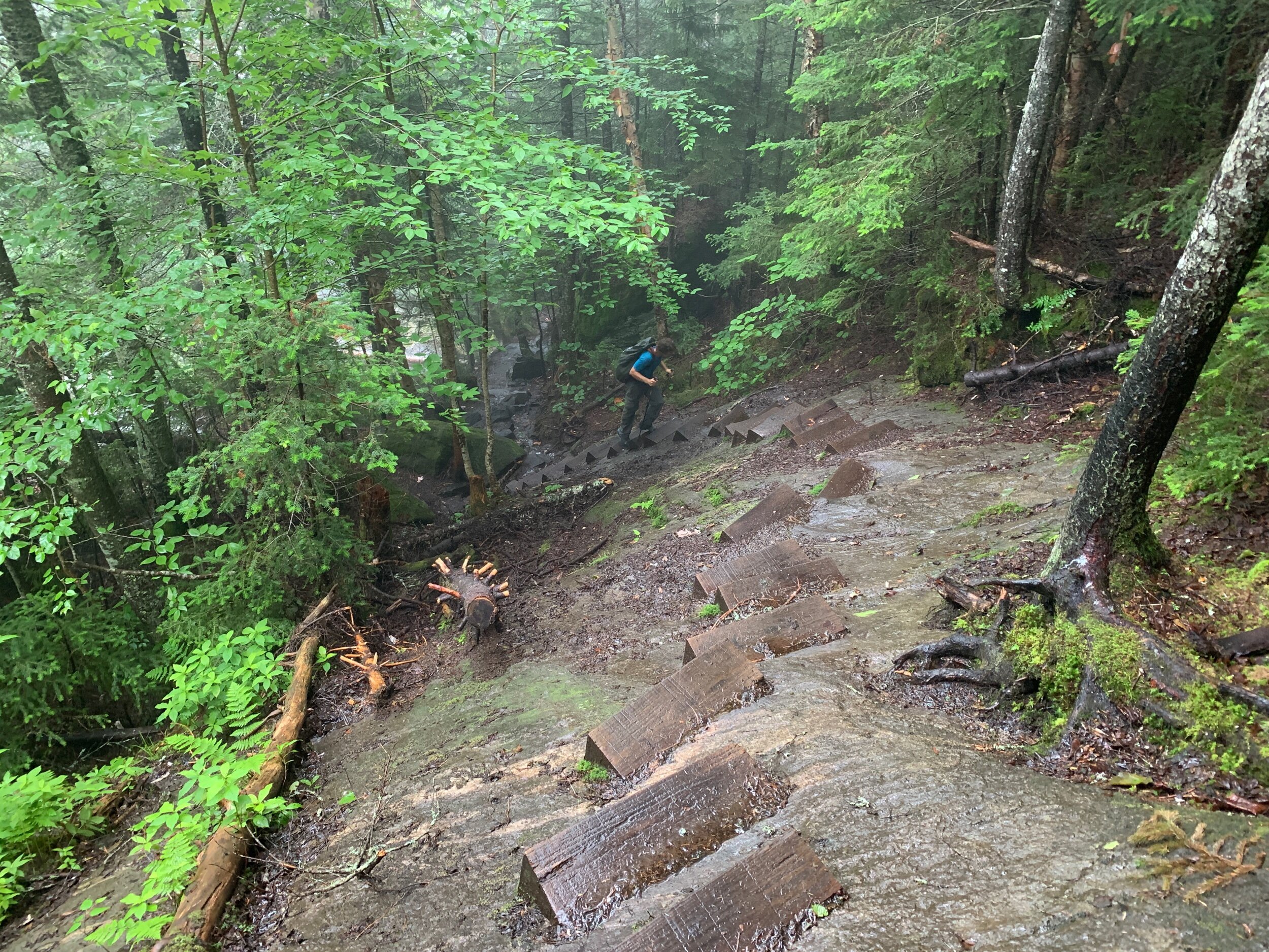
The shuttle for the Moosilauke slackpack departed at 7:30 and Atticus drove us to the northern side of the mountain so we could slackpack 10 miles over the mountain and then return to the hostel for one more night. The other people signed up for our shuttle bailed in the morning because of the bad weather risk so it was just us in the van. We just needed to make it up the 1.5 mile extremely steep grade ascent along Beaver Brook before the rains hit, because of how treacherous it becomes when the falls are raging.
Beaver Brook
We were glad to be climbing rather than descending such a steep and slick route and ended up greatly enjoying the climb for its unique challenge and beauty.
At times we had these funny little steps to climb!
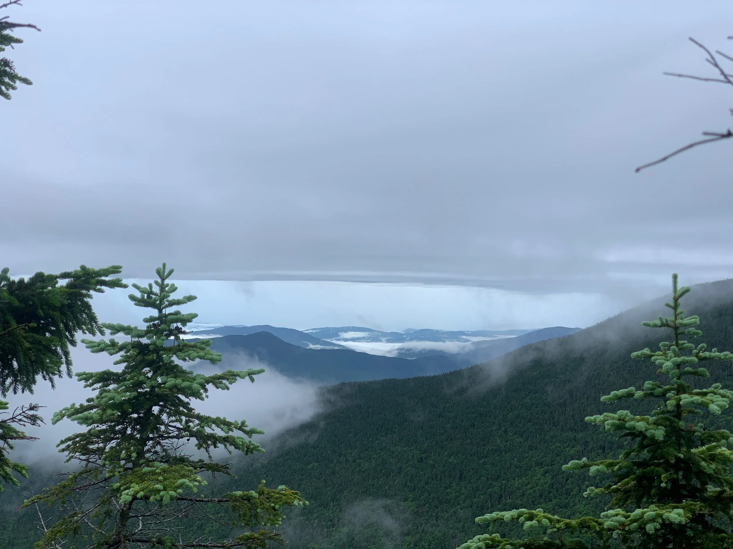
Once on top of Moosilauke we found ourselves in thick cloud soup and enjoyed occasional patchy views as the clouds swirled around the valley below. From the mountain top we could see light, puffy clouds below us and dense, dark clouds above. Hurricane Elsa hovered visibly in the distance to the east, dumping buckets of rain just a few miles away from us.
Hurricane Elsa to the East
Despite this, we never encountered anything heavier than a sprinkle. There were few people out on the mountain today, but we did cross paths with Bess and PB & Jazz, JP and Zane.
The hike down was also quite steep, though manageable, and as we approached the base of the mountain, we were relieved to have bagged our first peak of the Whites. It felt a bit like releasing a pressure valve with the excitement and anxiety that had subtly built up about the Whites as we approached over these past couple weeks. There is so much hype built up around these mountains in the hiker communities—and rightfully so—but anyone who has made it this far on the AT is well equipped to engage in the appropriate planning, preparation, and risk assessment for a successful crossing. Toward the end of the hike, we passed through a monarch rehabilitation field and saw a couple monarch butterflies fluttering around the milkweed!
The choice to summit Moosilauke with a hurricane passing so close was not without significant risk, but we had come out on top in this one. I joked to Ranger that of course a hurricane that shares a name with my grandmother wouldn’t hurt us!
Back at the hostel we snacked, showered, and relaxed with the others. Sitting that afternoon with Dallas, Lighthouse, Meta, Grasshopper and Mountain Goat eating our respective dinners, it began to pour suddenly while the sun remained out the entire time. It was exciting experiencing such heavy rain in the bright light of the afternoon sun and the droplets glittered and glinted all around us like falling jewels.
Lighthouse, Mountain Goat, Grasshopper, Meta, Dallas
We also discovered that Lighthouse is a secret YouTube star! His followers call him the Bob Ross of hiking because of his calm demeanor: https://youtube.com/c/ShakerHikes
Day 137: 11.5 miles hiked (trail mile 1815.2)
At 8am we were dropped at Kinsmans Notch with full packs containing only 1.5 days of food for the next 17 miles to Lincoln, NH. The elevation profile is deceptive, and our shuttle driver had adamantly discouraged us from attempting to do the entire thing in one go. This was absolutely the right decision.
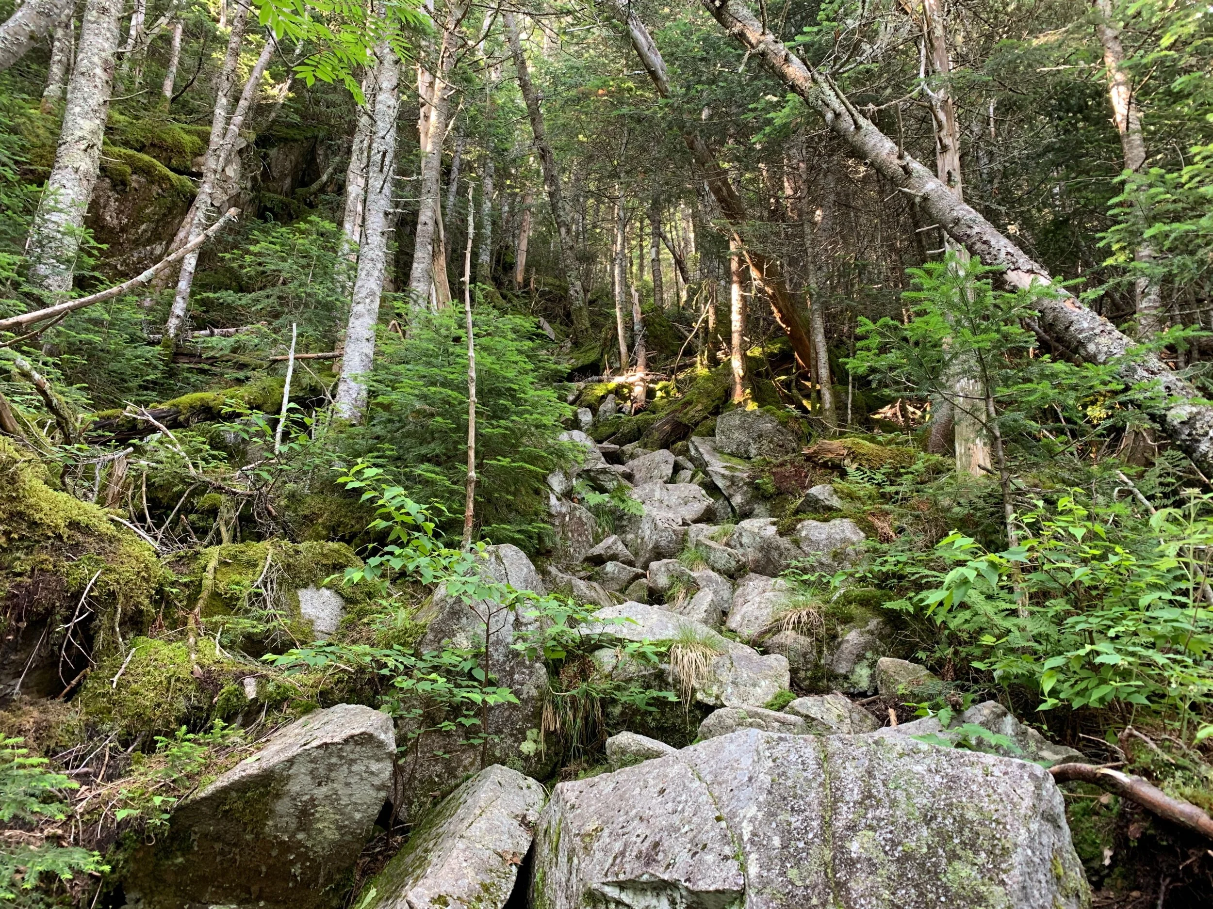
The terrain all through the Kinsmans was incredibly challenging and all in all it took us a little over 10 hours to go a mere 12 miles. Even the sections without major elevation gain consisted of giant, slick boulders that we had no choice but to scramble 10 feet up, 10 feet back down, rinse and repeat.
A boulder scramble with some nice roots to assist
Killer, Wizard, Ranger
We braked for lunch at Eliza Shelter then climbed a 2.5 mile steep ascent (that began by following a cascading waterfall) to the top of the Kinsmans we found ourselves in stretches of long, uninterrupted scrambling by hand and foot.
The trail
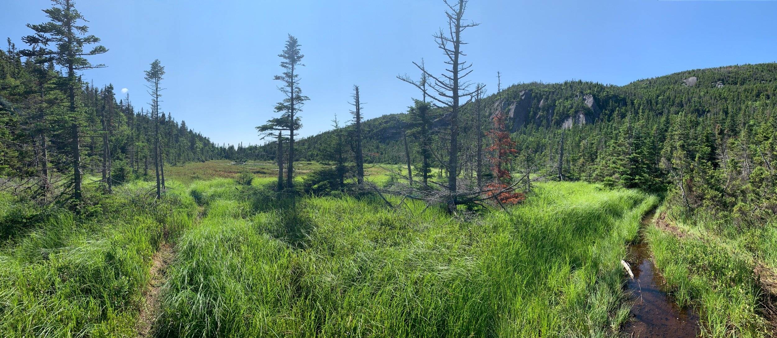
At one point we passed a breathtakingly beautiful, boggy mountain pond surrounded by crimson red carnivorous plants.
We enjoyed many stellar views and could see Franconia ridge, where we are headed, from an overlook on the south side of the Kinsmans about half a mile from the shelter.
The descent from the ridge was highly technical and steep, and we arrived at Kinsman Pond Shelter at 6pm to find an absolutely jam-packed campsite. The Whites are a popular weekend destination for overnighters which seemed to make up the bulk of the population at the site this Saturday night. Unable to find a site to pitch our tent we squeezed into the last space available on the top level of the shelter.
Although campsites are paid in the Whites the Caretaker never showed up to collect our dues – perhaps we just missed them getting seconds before sundown, as is our habit. We filtered water from the lily pad and tadpole-filled mountain pond and had an unfortunately stale tasting Backpacker Pantry Pad Thai for dinner.
Day 138: 4.9 miles hiked (trail mile 1820.1)
This morning we hiked from Kinsmans Pond Shelter to Lonesome Lake Hut, the first that we’ve encountered of the hut system sprawled across the Whites. Each is placed about eight miles apart. A bunk in a hut costs about $175 a night so most of the time thruhikers stay in the shelters/campgrounds for $10 a person or find stealth sites by either knowing where to look for keeping an eye out for little paths that look a bit like game trails but lead to well-worn sites tucked just a short ways off trail (generally these can be found fairly close to the huts).
Inside Lonesome Lake Hut
Historically, the huts used to allow thruhikers to sleep in the dining rooms in exchange for a couple hours of labor, which is how Ranger did it on his first thruhike 15 years ago, but this has been phased out because of the pandemic. Regardless, the huts are fun to stop in at for a baked good or bowl of soup, or if you get lucky, some leftovers from the meals prepared for the paying guests. They are also a chance to escape the severe and sudden weather that can occur in these mountains or use a sparkling clean composting toilet (as opposed to the fearsome privies that thruhikers become accustomed to at the shelters).
Inside Lonesome Lake Hut we lucked upon a big stack of leftover pancakes, some scrambled eggs, and oatmeal. We hung out for a minute to graze on breakfast items and identified some of the plants we’ve been seeing from a small botanical guide for the region.
With only two miles left to the parking lot where we intended to get a ride into Lincoln, we iced our feet for a few minutes in the lovely and absolutely freezing Cascade Brook.
When we got to the interstate crossing, we hiked off trail about a mile to the Flume visitor center where we attempted to get a hitch to town. Tourists at the visitor center must be out-of-towners with no awareness of the proximity to the AT, because we stood there for about a half hour to no avail. Some people even rolled up their windows in obvious apprehension as they approached. We were about to give up and try to call a shuttle when Meta’s sister drove by and picked us up! She was in town to pick up her son Mountain Goat, Meta’s nephew, as his section hike with his aunt and uncle was coming to close.
They dropped us at Chet’s Place. Chet is an experienced trail angel that was accepting hikers on a word-of mouth-only basis during the pandemic. We had lucked out and met someone a few days before who gave us his info. Chet is a former hiker who is now wheelchair bound due to an accident. For the past 13 years he has hosted thruhikers as a way of supporting the hiker community. He converted his garage into a large bunk space and common area for hikers with 24-hour access to the bathroom and laundry facilities in his basement. While he used to host 6-8 hikers a night, he dropped his numbers way back as a result of the pandemic coming right on the heels of some unfortunate incidents with addicts posing as hikers taking advantage of the space for drug binges.
Chet has a heart of gold and we loved taking time to get to know him and hearing of some of his incredible former adventures in the Whites.
From Chet‘s we were able to take a short walk into town where we saw a bunch of other hikers also resupplying for the next five day section of the Whites. In town we took care of laundry, resupplied at the Price Chopper and the outfitter, shared an ice cream cone, and had Mexican food for dinner.
JP and Zane rode by on some loaner bikes from the Notch Hostel while we were eating dinner
Just as we were winding down for bed, we met Teri (Pterodactyl), another prominent thruhiker-turned-trail-angel of Lincoln. He swung by just to chat for a spell and shared some fun stories from the trail as well as encouraged us not to worry too much about the storms on the forecast. Despite the shared love of the AT, Chet and Teri were comically opposite in demeanor, and where Chet was gentle, soft spoken and deeply concerned for our wellbeing with the storms on the forecast, Teri was bold, excitable, and told us to get out there, weather be damned.
He wisely reminded us that the weather can change on a dime in these mountains and pointed out that the locals love to tell hikers how bad the weather is going to be up there only for it to turn into a lovely day. Once Teri cleared out, we had the place all to ourselves for the night and are grateful for it.
Day 139: 10.7 miles hiked (trail mile 1830.8)
Today was our first day in the Whites with our full packs. We expect this next 50-mile section of the Whites, over the Presidential range to Pinkham Notch, to take us five full days at a little over 10 miles a day. Due to the elevation changes, scrambling, technical sections, and weather that can turn deadly on a dime, the general guidance for planning a hike in the Whites is to take your normal daily mileage and cut it in half.
We said our goodbyes to Chet and got a shuttle to the trailhead. When we asked Marlene if she would drop us right on the side of the interstate where the trail goes underneath, rather than at the parking lot a mile from the trail, she obliged which set our day off to a great start.
We started climbing at 8am and climbed about 4000 ft to Mount Lincoln where we arrived shortly before noon. On top of Lincoln we were reunited with friends including Dallas, Lighthouse, Mama Bear and Baby Bear, and Blueberry. We ate our lunch on the peak together and enjoyed the spectacular 360 degree views while clouds swirled all around us.
Blueberry, Mama Bear, Baby Bear, Dallas, Sticks, Ranger
Next, we summitted Mt Lafayette, then finally Mt Garfield. We opted to skip Garfield shelter in favor of stealth camping, to save a few dollars.
We found a cozy stealth site tucked a short distance into the woods and barely visible from trail. The rest of the evening was spent taking care of camp chores and we turned in early, by 7:30pm.
Jeff, a man in his 70’s who is hiking the ECT (Eastern Continental Trail) from Key West, Florida to Newfoundland, of which the entire AT is a middle section, walked into our camp around 8 on his own quest for a stealth site and we directed him to a site a few yards beyond our own.
As challenging as these sections of the Whites have been, it’s incredible being able to stop a bit earlier than usual in camp and not worry about pushing big miles.
Delicate alpine vegetation
Day 140: 12.1 miles hiked (trail mile 1842.9)
We had a restful night at our awesome stealth site. After checking the forecast and seeing that rain was coming in at 7am we scrambled to break down camp by 6:30 and hit the trail.
Rain arrived as scheduled and we arrived at Galehead Hut soggy but with the satisfaction of having a dry tent in our packs. The hut had vegan chocolate cake and coffee available, and we sat there for about an hour or two waiting for the storm to pass.
A bunch of other thruhikers bottlenecked here with us because of rain, including JP and Zane, the Cornell Kids, Mama Bear and Baby Bear, Jeff (who was apparently awoken by the downpour) and a few others. The rain continued to increase in intensity, so we waited until 9:30 when it finally began to let up before climbing South Twin Mountain.
Zane and JP
Jeff (ETC hiker) and Ranger
There were no views to be had since we were in the clouds, but we were fine with the cool temperatures.
Just before reaching Zealand Hut we braked to enjoy lunch on a ledge next to a waterfall. Swiss Miss’s mom, who is joining her daughter through the Whites as they hike together from hut to hut, slipped upstream and dropped her trekking pole into the fast-moving brook. The pole was carried downstream, and we were able to rescue it before it went over the falls.
At Zealand Hut we had a bowl of lentil soup and a slice of lemon ginger cake, then hiked another three miles until we found a good stealth site next to Pemigewasset River. We finished with camp chores by 7pm and will try to get an early start tomorrow.
Day 141: 11.1 miles hiked (trail mile 1854)
We left our stealth site by 7am and swiftly hiked a gentle five miles by 9:30am, then began the three mile climb up to Mount Webster. There was some fun scrambling toward the top where we just collapsed our poles and climbed by hand and foot.
On top of the ridge, we also crossed an alpine bog of liquidy black mud that was as deep as a fully extended trekking pole in some areas where we tested it. There were faint footprints in some areas telling of poor souls who overestimated the strength of a foothold or just totally missed their mark, presumably never to be seen again… joking… maybe.
We made it to Mizpah Hut by 3pm and got a great tent site on one of the elevated platforms in Nauman Campsite near the hut. The area around the hut as we approached was like a green waterlogged sponge, so finding a good stealth site seemed unlikely. Dallas, Blueberry, and Lighthouse splurged on a bunk in the hut while JP, Zane, Mama Bear, Baby Bear, Hiccup, Prime and the other thruhikers in our vicinity set up in the tenting area.
We paid $10 each and received a “pass” that enables us to get $5 off at the next paid AMC (Appalachian Mountain Club) sites we stay at if we present the pass, 2 free baked goods from the huts, and a free bowl of soup. This was our first time having to set up our tent on one of the infamous wooden tenting platforms throughout the Whites and it was tricky to stake out the rainfly though we did eventually manage to rig it. These platforms are an even bigger challenge for people who use trekking pole tents, but we saw people hack together a solution time and time again.
AMC Hut staff pack in all hut supplies using these giant wooden pack frames!
Ranger played Settlers of Catan with others at the hut and explored the upstairs library with Zane while I took a nap in our tent. The huts are known for giving hikers leftovers from the meals that they make for customers staying at the hut, so when I meandered back to the hut around 8pm there were about a dozen thruhikers hovering around in hopes of free food. The hut did not disappoint, and they clattered serving dishes consisting of the day’s remains of rice, meat, veggies, and bread along with small plates and eating utensils so we could all partake, buffet style. Thruhikers are clearly one of the initial stages of the waste-reduction/composting process at the huts.
Mizpah Hut had one of the nicest dining spaces
We were also able to use our AMC pass to once again get a couple free slices of vegan chocolate cake!
Tomorrow will be a big day as we will be hiking from Mizpah Hut to Osgood tent site at the base of Mt Madison. This will be about 14 miles in total, including the 12-mile stretch above treeline referred to as the Presidentials.
Day 142: 14.9 miles hiked (trail mile 1868.9)
Because we had read and heard how challenging the terrain would be today, we got a 6am start out of Mizpah along with Baby Bear, Mama Bear, JP and Zane, Dallas, and Lighthouse.
From Mizpah we climbed rapidly above tree line and were met with an incredible early morning landscape above the clouds.
We hiked strong the first five miles or so to Lake of the Clouds hut where we met a croo member who explained how they are measuring clouds here at the base (and top) of Mt Washington. The cloud measuring device added to feel of otherworldliness in this stretch.
Lake of the Clouds Hut
Cloud measuring device
Apparently our 6am start wasn’t early enough because by 8:30 they were already cleared out of breakfast leftovers. So, there was nothing to do but begin our climb of Mount Washington. Mount Washington is touted as having the worst recorded weather in the United States and frequently has sustained winds of over 200mph. Hikers are repeatedly warned by maps, signs, and conversationally, not to attempt to complete this stretch of the Whites if there is even a chance of thunderstorms, so we are very fortunate to have this one clear day amidst the storms of late. We wonder aloud what our friends one day behind us will do tomorrow if the forecasted storms come to fruition.
In the distance we could hear the whistle of The Cog, the first mountain-climbing train established in the world that carries hundreds of visitors a day to the top of Mount Washington, the highest peak in the Whites. At the top of Mount Washington sits a gigantic visitor center complete with a museum, gift shop, and cafeteria. We ate our peanut butter sandwiches with snack bar supplements and waited for a gap in train loads to get our photo next to the popular Mount Washington sign with its ugly backdrop of the visitor center.
The Cog Railway
Beginning with Mt Washington the terrain degraded into a seemingly never-ending talus field, and we poked along climbing mountain after mountain at what felt like a turtle’s pace. The views were incredible all day long, as well as the unique alpine vegetation, and kept our spirits up.
Alpine vegetation is so delicate and special
Faster, more nimble hikers than us took the side trails to bag the peaks that weren’t directly on the AT, and then would come flying past us again further along. But we knew if we were to make it out before dark we needn’t diverge from the designated path.
The trail was marked by cairns through the talus fields
In the evening we reached Madison Hut, positioned right beneath Mt Madison which was to be the challenging finale to the Presidentials. At the hut we stopped to collect ourselves and made one of our best meals on trail yet: dehydrated ReadyWise veggie chili with Fritos, the last of our dehydrated trumpet mushrooms from Hanover and nutritional yeast.
Here we met a guy who told us how he quit the AT on an attempted thruhike a few years ago after getting caught in an unexpected thunderstorm on his way to Lake of the Clouds Hut. He said he had been so terrified for his life as he stumbled along in the sudden pitch black, thunder, lightning, and high winds that he had bartered with God for his life, promising that he would immediately return home to his wife should he survive the ordeal. When he finally made it to the hut alive, he bailed off the mountain, and the AT, the very next day. Now he is back to finish the final stretch of his journey to Katahdin.
Fueled by our incredible chili Frito pie and some fresh lemonade from the hut we enjoyed the steep climb up Madison. The climb was immediately followed by a steep and highly treacherous 2.5-mile, 3,000-foot descent down a massive talus slope to Osgood campsite. I wish I had taken a photo but was at the time too consumed by the task at hand to take out my phone. Guthooks user comments on this section said things like, “Satan would be impressed” and “this section was designed by a sadist.” I nearly kissed the dirt when we finally made it back below tree line. We trudged into camp with our last energy reserves just before darkness crept in and set up our tent on a group tenting platform next to Hangin’ and Belch, who have the same tent as us, Big Agnes Cooper Spur UL2 – except theirs is a 3-person.


